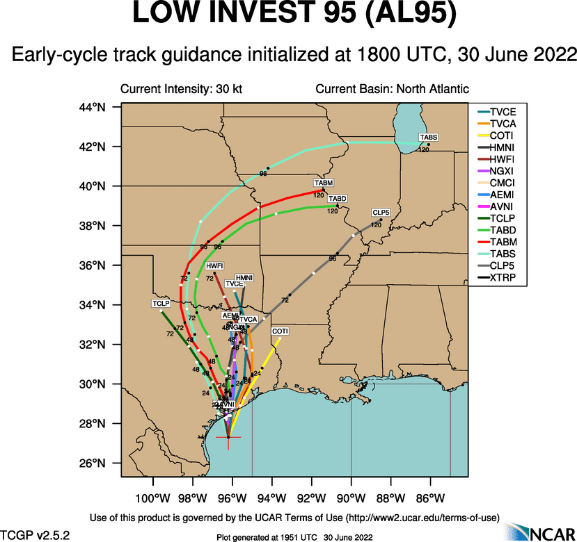
Afternoon satellite and radar imagery indicate showers and thunderstorms associated with that area of low pressure off the southern coast of Texas (invest 95) have changed little in organization since this morning. The system remains fairly disorganized. Today, most of the rain associated with the disturbance has been well offshore of the Texas coast, with the rain wrapping inland over Galveston Bay. Forecasts call for the low pressure area to move slowly to the north this evening and tracking inland near Matagorda Bay sometime late Thursday night. From there, the majority of the forecast solutions call for the low to track northeast to a position near College Station Friday afternoon, and to just east of Dallas on Saturday.
The majority of the rain associated with the low pressure system is predicted to occur around the eastern side of the low, with just light amounts of precipitation on the western side. With that in mind, the majority of the rain from the low is expected to occur to the south of Interstate 10, with a special emphasis near the coast across Matagorda County. Across this area, showers and thunderstorms are forecast to increase after midnight Thursday night, with periods of rain and storms continuing Friday through Friday night. Some additional showers and thunderstorms will also be possible on Saturday, with the chance for rain diminishing Saturday evening. The rain may be heavy at times. The National Weather Service has posted a Flood Watch for Wharton and Matagorda Counties through Friday evening.
For the Hill Country and Central Texas regions, just a slight chance for afternoon showers and thunderstorms is forecast Friday and Saturday afternoons.
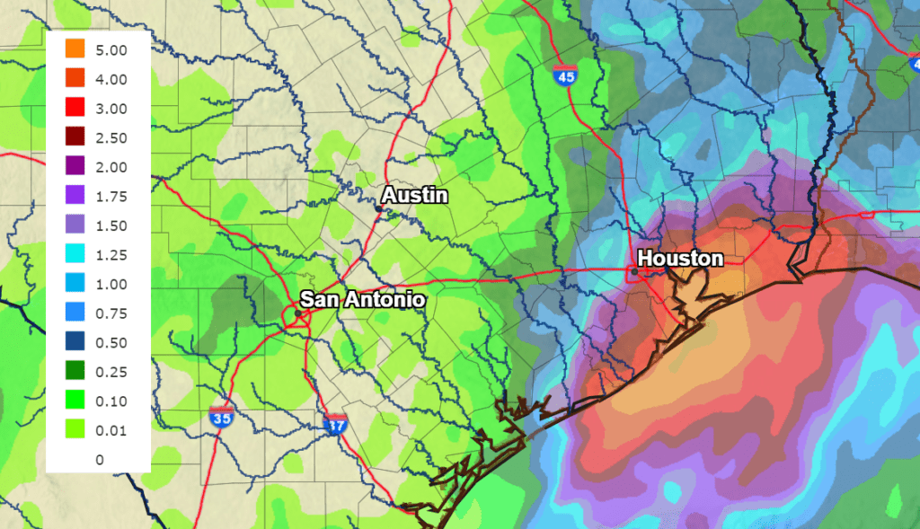
Rain amounts between this evening and Saturday evening are forecast to be heaviest across Matagorda County, where totals of 2-4 inches are predicted. Isolated totals of 4-6 inches will be possible. Across Wharton County totals of 1-2 inches are forecast, and across Colorado County, totals are forecast to average less than an inch. For the Hill Country and Central Texas regions, totals are forecast to generally average less than a quarter inch.
NWS Rainfall Forecast for the Period 7 pm Thursday through 7 pm Sunday:
A sunny, dry, and hot weather pattern is forecast to set up Sunday as the low lifts off to the north and the large heat dome returns to Texas. This dry and hot pattern looks to persist throughout all of next week. Triple digit temperatures appear likely.
Bob
Social Media