The hottest temperatures of summer are forecast to develop across much of Texas next week. The summertime heat dome which hasn’t spent very much time over Texas this summer, is forecast to shift from the central Rockies to the central and southern Plains states beginning early next week. The ridge is predicted to park itself over this general area for most of the week, sparking a heat wave for a good part of the central and southern U.S.
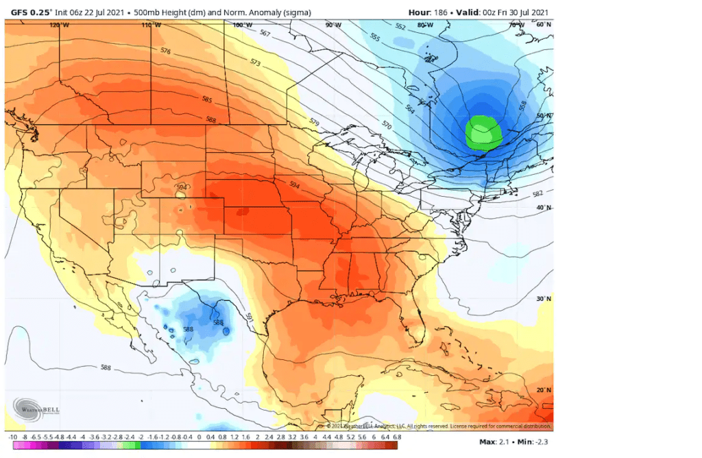
A sprawling heat dome is forecast to occupy most of the Lower 48 next week as depicted in the American GFS model simulation. (courtesy WeatherBell)
While the center of the heat dome is forecast to remain just north of the Red River, it will be close enough to cause the development of sunny, dry and hot weather across much of Texas. Parts of North Texas may see the hottest readings so far this summer, with highs in the upper 90s to low 100s. Across the Hill Country and Central Texas, temperatures are forecast to generally reach the upper 90s, while the coastal plains should see highs in the low and mid-90s.
A weak, non-tropical area of low pressure is forecast to track inland along the middle Texas coast early next week. This system is expected to push a limited amount of tropical moisture from the coastal plains into Central Texas next Wednesday and Thursday. This may result in the development of a few spotty afternoon rain showers and isolated thunderstorms, but rain amounts should be low. The scattered clouds might help moderate the temperature down a couple of degrees from the upper 90s.
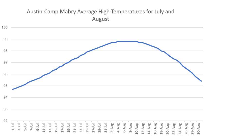
A forecast for temperatures in the upper 90s the last week of July actually follows typical summer trends. The updated 1991-2020 climate normals for Austin show the average high temperature the last week of July to be 98 degrees. This is a prelude to the hottest point of summer typically occurring the first and second weeks of August. The new normals show the period August 4 through August 10 to have the hottest max temperatures of summer, with an average high temperature of 98.8 degrees. Average high temperatures begin to lower steadily following this peak in early August, with readings down to 95 degrees by August 31st.
It’s been a tolerable summer so far. Let’s see if August lives up to its reputation for being the hottest and most oppressive month of summer, or will the more tolerable temperatures of July persist?
Bob
Social Media