Tropical Storm Grace strengthened into a hurricane Wednesday morning as it passed west of Grand Cayman. As of late Wednesday afternoon, Grace was situated over the western Caribbean Sea—roughly 250 miles east of Tulum, Mexico. Afternoon satellite images showed the hurricane was fairly well organized, with some convective banding features and very cold cloud tops, mainly over the eastern portion of the hurricane’s circulation.
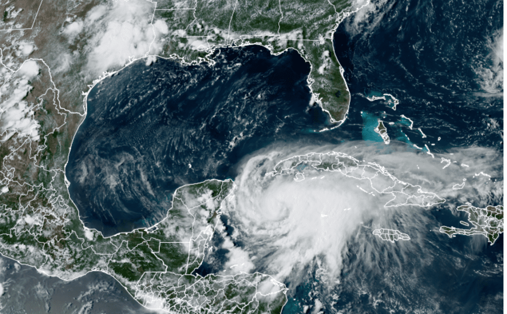
NOAA/Colorado State University/RAMMB 08/18/2021 3:30 pm CDT
Grace was moving toward the west-northwest near 16 mph. Grace is being steered to the west-northwest along the southern periphery of a ridge of high pressure centered over Cuba and southern Florida. This general motion is expected to continue for the next several days, keeping Grace from lifting north towards Texas. On the current forecast track, Grace is expected to make landfall in the eastern Yucatan Peninsula Thursday morning, move over the Yucatan Peninsula on Thursday, moving over the southwest Gulf of Mexico Thursday night or early Friday. Grace is predicted to push inland as a hurricane somewhere south of Tampico, Mexico late Friday night or early Saturday morning.
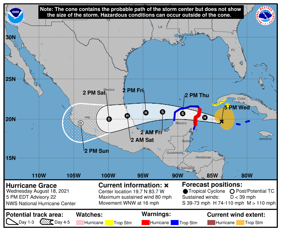
Maximum sustained winds were near 80 mph with higher gusts. Some strengthening is possible before the center of Grace reaches the Yucatan Peninsula. Weakening will occur while the center moves over the Yucatan Peninsula on Thursday, with restrengthening expected when Grace moves over the southwest Gulf of Mexico on Friday.
With Grace taking such a southerly path, little to no impacts are expected along the middle and upper Texas coast. Outer rain bands are forecast to spread across the lower Texas coast Saturday through Sunday, but rain amounts are forecast to only average around a half inch. Swells from Grace are forecast to cause elevated surf and seas along the lower coast.
Across Central Texas and the Hill Country, a drier and warmer pattern is forecast to set up across the region Thursday and persist through the weekend. A few spotty afternoon showers will be possible for areas east of Interstate 35, but rain amounts, if any, should be quite low. High temperatures will be in the mid-90s Thursday and Friday, warming to the upper 90s over the weekend.
The outlook for next week calls for sunny, dry and hot weather as a large ridge of high pressure spreads over Texas out of the Gulf of Mexico. High temperatures Monday through Wednesday are forecast to be near 98-100 degrees across the Hill Country and Central Texas regions. High temperatures should lower slightly to upper 90s next Thursday and Friday.
Bob
Social Media