Ever since the last widespread rain in early September, the weather has been bone dry across Central Texas. This has been an unusually dry spell of weather as September and October are typically a fairly wet time of the year. But some rain is finally on the horizon for Sunday and early next week.
Wednesday’s forecast data calls for a strong cold front to sweep south across Central Texas Sunday afternoon into Sunday evening. Ahead of the front, scattered rain showers and isolated thunderstorms are forecast to develop. But an even better chance for rain showers and thunderstorms is forecast to develop Sunday night through Tuesday afternoon when a trough of over the Desert Southwest tracks to the northeast, causing a wet and unsettled pattern across much of Texas. The rain is expected to taper off late Tuesday, with dry weather returning Tuesday night.
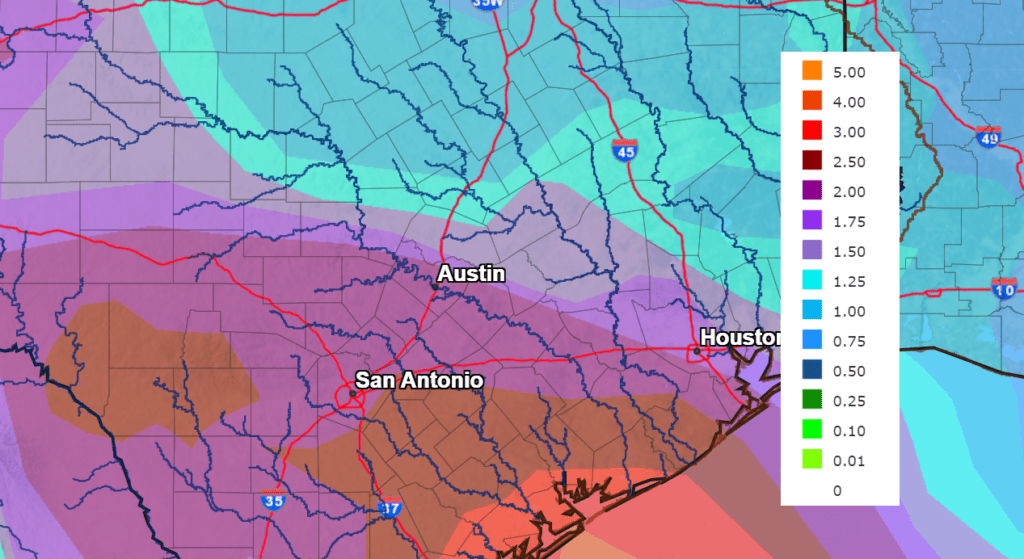
The National Weather Service is forecasting some nice soaking rains over the upcoming period, with most areas expected to receive between 1 and 2 inches of rain.
NWS Rainfall Forecast for the Period 7 pm Wednesday through 7 pm next Wednesday:
Temperatures are forecast to trend much cooler early next week behind Sunday’s cold front. Expect high temperatures in the 70s and lows in the 50s.
Bob
Social Media