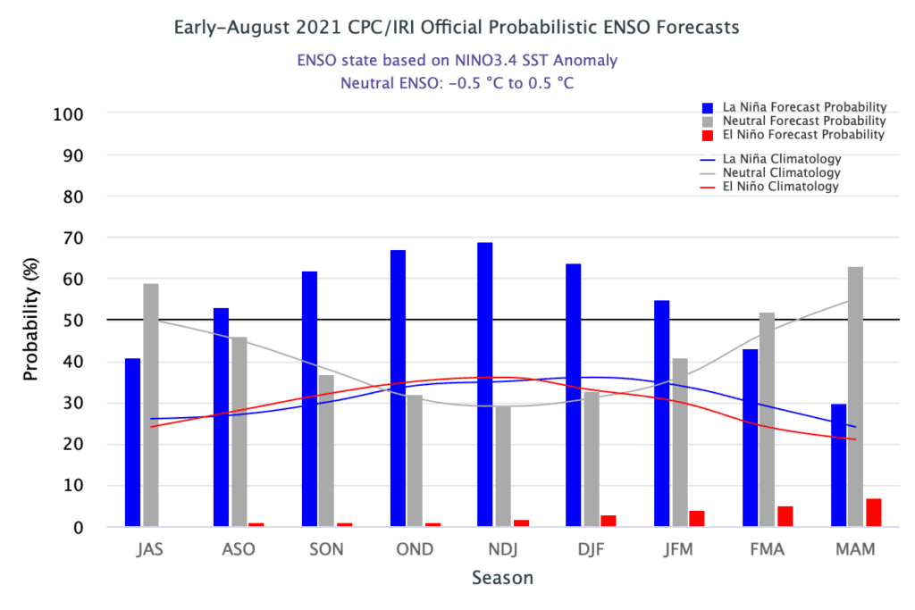
While ENSO-neutral conditions continue across the tropical Pacific, ENSO’s next performance may be approaching. On Thursday, forecasters with NOAA’s Climate Prediction Center increased the likelihood for La Niña to develop by winter to 70 percent. With that in mind, the La Niña Watch posted last month remains in effect.
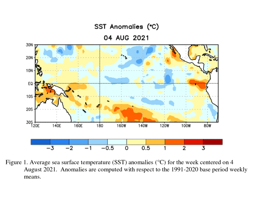
Sea surface temperatures I(SSTs) in the central and east-central equatorial Pacific in early July were near-to slightly-below average. Interestingly off the coast of South America, SSTs were running above average.
But below the surface, some big changes have taken place over the past month. Here, Pacific Ocean temperatures took a sharp downward turn, breaking the string of several months of above-average sub-surface temperatures. If these below-average subsurface temperatures persist, they may provide a source of cool water for the onset of La Niña this winter.
Low-level wind anomalies were easterly over the east-central Pacific Ocean, while upper-level wind anomalies were westerly across the eastern Pacific. Taken together, this pattern points toward a strengthened Walker Circulation, which gives us a hint La Niña is itching to return.
So, are all of these recent changes just a temporary blip or a sign of the return of La Nina? Recent computer-model runs from the NCEP CFSv2 and the North American Multi-Model Ensemble suggest this is more than just blip, with indications the equatorial SSTs will cool further into La Niña territory in the coming months. Most other forecast solutions also predict the onset of La Niña sometime this fall.
The Climate Prediction Center’s official outlook calls for ENSO-neutral conditions to continue for the remainder of summer (~60% chance August-September season). The outlook is forecasting a 60-70% probability for La Niña to develop this fall, with La Niña lasting through the 2021-2022 winter. The likelihood of El Niño developing this fall and winter is extremely low (less than 4%). So, if La Niña doesn’t develop this fall, then it’s a good bet the Pacific will remain ENSO-neutral.
The development of La Niña could promote a drier-than-normal and warmer-than-normal weather pattern this fall and winter across Central Texas—very similar to what we observed last fall and winter.
Stay tuned for further updates over the next couple of months.
Bob
Social Media