La Niña is still going along nicely. That’s the latest word from NOAA’s Climate Prediction Center (CPC). In an update published Thursday, CPC forecasters noted a tongue of below-average sea surface temperatures (SSTs) expanded across the central and eastern equatorial Pacific Ocean during July. In fact, the weekly Niño indices indicated there has been renewed cooling, with the latest Niño-3.4 and Niño-4 indices reaching -1.0°C anomaly.
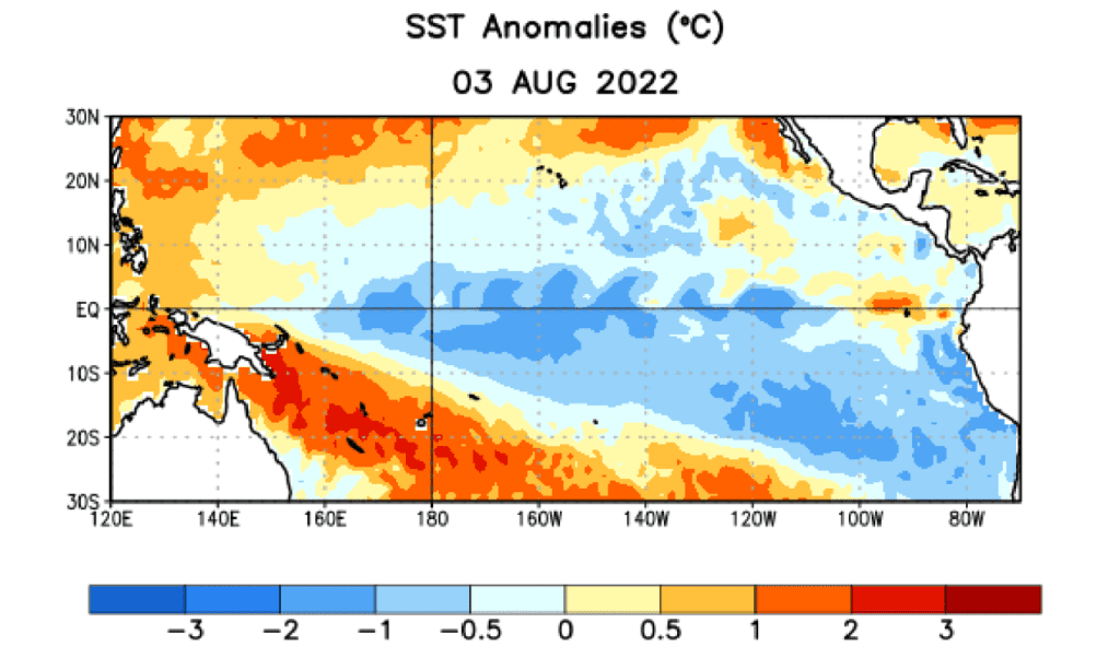
Average sea surface temperature anomalies (degrees Celsius) for the week centered on August 3, 2022. Anomalies are computed with respect to 1991-2020 base period weekly means.
Subsurface temperature anomalies also decreased rapidly in the past month, reflecting the reemergence of below-average subsurface temperatures across the east-central Pacific Ocean due to an upwelling Kelvin wave propagating eastward. Low-level easterly wind anomalies and upper-level westerly wind anomalies persisted across most of the equatorial Pacific. Convection and rainfall remained suppressed over the western and central tropical Pacific and enhanced over Indonesia. Overall, the coupled ocean-atmosphere system remained consistent with an ongoing La Niña.
In regards to how long La Niña will last, the CPC forecaster consensus, supplemented with the latest output from the North American Multi-Model Ensemble (NMME), concurs that La Niña is the most likely outcome through the upcoming fall and winter. While a majority of NMME models suggest that La Niña will transition to ENSO-neutral in January-March 2023, forecasters are split on this outcome, resulting in equal forecast probabilities for La Niña or ENSO-neutral during that season.
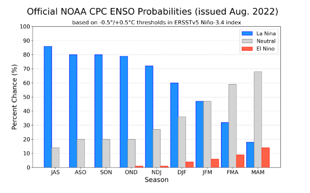
Official ENSO probabilities for the Nino 3.4 sea surface temperature index. Figure updated August 11, 2022.
In summary, La Niña is expected to continue, with chances for La Niña gradually decreasing from 86% in the coming season to 60% during December-February 2022-23.
Bob
Social Media