After roughly six months with the tropical Pacific holding in ENSO-neutral (neither La Nina of El Nino), the National Oceanic and Atmospheric Administration announced Thursday La Niña has returned and it is expected to stick around through late winter.
La Niña is more or less the opposite of El Niño, which often makes headlines for pushing powerful storms that can bring beneficial rains to California, Texas and much of the southern U.S. During La Niña, however, such winter storms tend to be less frequent as the storm track shifts toward the northern U.S. That keeps the northern U.S. anomalously wet while the Texas and the southern U.S. is left largely mild and drier than-normal.
According to NOAA’s Climate Prediction Center, La Niña conditions emerged in September, as below-average sea surface temperatures were observed across the central and east-central equatorial tropical Pacific [Fig. 1]. In the last week, these cool waters surpassed the threshold La Niña.
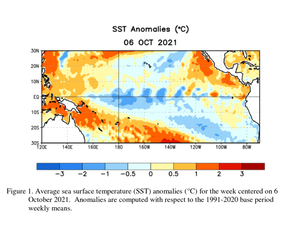
Below the surface, negative temperature anomalies strengthened at depth across most of the central and eastern Pacific Ocean. In addition, low-level easterly wind anomalies and upper-level westerly wind anomalies were in place over most of the equatorial Pacific. Tropical convection was suppressed near and west of the Date Line and enhanced over Indonesia. Overall, the coupled ocean-atmosphere system was quite consistent with La Niña conditions.
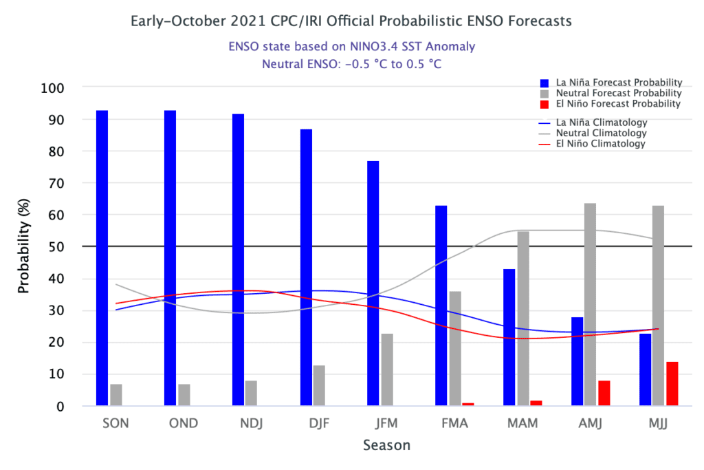
The IRI/CPC plume average of computer-forecasts favors La Niña to continue through the fall and winter 2021-22 (87% chance). Interestingly, CPC forecasters anticipate La Niña will be fairly short-lived, with ENSO-neutral conditions predicted to return sometime between March and May 2022. Because of the recent oceanic cooling and coupling to the atmosphere, CPC forecasters anticipate a 57% chance for the La Niña to be of moderate-strength at its peak.
La Niña is expected to have a large influence on the weather across the nation, including Texas, this winter. Winter forecasts depend on far more than just La Niña, but it is one of the primary influences. The Climate Prediction Center is slated to issue their updated winter (December through February) outlook next Thursday, Oct. 16th. Their mid-September outlook showed high probabilities for milder-than-normal temperatures and below-normal precipitation across Texas this winter. Stay tuned for the updated outlook next week.
Bob
Social Media