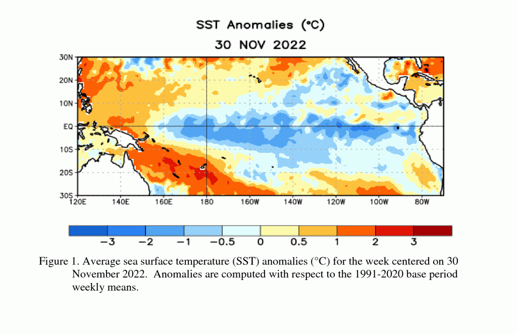
A weak to moderate La Niña continues. In their December update, Climate Prediction Center forecasters noted a mature La Niña is in place and is currently showing no signs of weakening. An analysis of Pacific sea surface temperatures over the past month showed a large tongue of cooler than-normal waters stretches from the west coast of South America, to just beyond the International Date Line. Low-level easterly wind anomalies and upper-level westerly wind anomalies were evident across most of the equatorial Pacific throughout the month, indicating a strong connection between the ocean and the atmosphere.
Interestingly, below the surface, the cooler than normal waters have recently weakened, and there has been an eastward expansion of warmer than-normal waters from the western into the central Pacific. This expansion of warm, subsurface waters may be an early sign La Niña could soon be on its way out, with the Pacific then returning the ENSO-neutral state. CPC forecasters point out all of the dynamical and statistical forecast solutions show La Niña persisting into the upcoming winter. The dynamical suite of solutions call for La Niña to end and the return of ENSO-neutral sometime between January and March. The statistical forecast solutions show this change occurring just a little later, sometime between February and April. But both agree the end seems to be in sight.
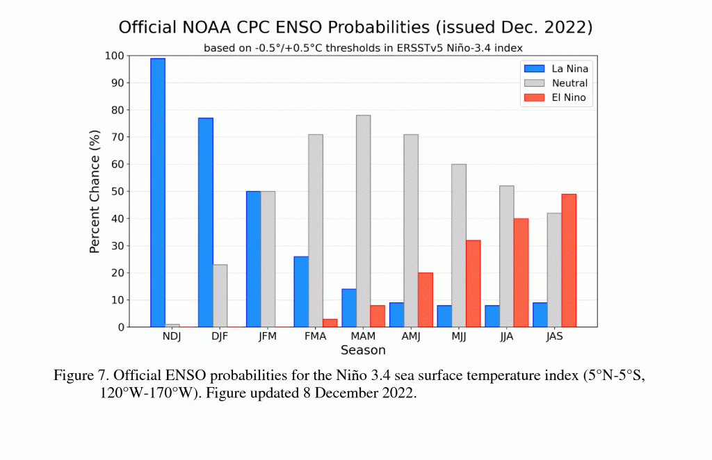
CPC’s updated forecast calls for equal chances of La Niña and ENSO-neutral during the period between January and March. However, between February and April 2023, forecasters show a 71% chance for ENSO-neutral conditions to develop, with the ENSO-neutral conditions forecast to persist into the upcoming summer.
After persisting for three years, La Niña’s demise seems to finally be on the horizon.
Bob
Social Media