Tropical Storm Wanda is defying late season odds and continues to churn across the north Atlantic. The system is maintaining bands of moderately deep convection near the center, mainly over the northwestern semicircle while at the same time showing anticyclonic outflow.
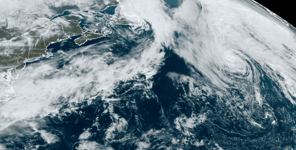
NOAA/Colorado State University/RAMMB 11/04/21 10:30 am CDT
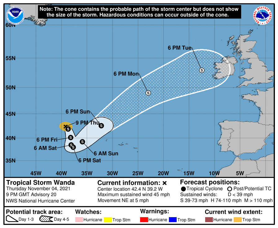
As of 4 pm CDT Thursday, the center of Tropical Storm Wanda was located about 710 miles west-northwest of the Azores. Wanda is moving toward the northeast near 5 mph. A turn toward the southeast is expected tonight, followed by a general southward motion Friday through Saturday.
Several forecast models call for Wanda to strengthen into a strong tropical storm over the next 48 to 72 hours. Between 72-96 hours forward, Wanda is expected to merge with a frontal system and National Hurricane Center forecasters call for Wanda to lose its tropical characteristics and become extratropical over the northeastern Atlantic. The storm’s remnants are predicted to spread toward Ireland by sometime late next Tuesday.
Bob
Social Media