The winter of 2021-2022 has so far been awfully dry. January has been especially dry, with several locations only seeing about a quarter inch of rain. The January pattern has featured several cold fronts, which have brought in quite a bit of cool air. But moisture return ahead of the fronts has been very limited, resulting in little to no rain.
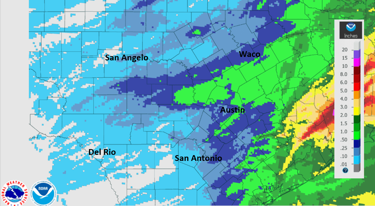
Rainfall estimates based on Doppler radar and gauge data shows January totals of just a quarter to a half inch across the Hill Country and Central Texas regions and totals of one half to one and a half inches across the middle Texas coast.
NWS Estimate of Rain Falling between January 1st and January 27th:
For most locations, January rain has been close to 2 inches below normal.
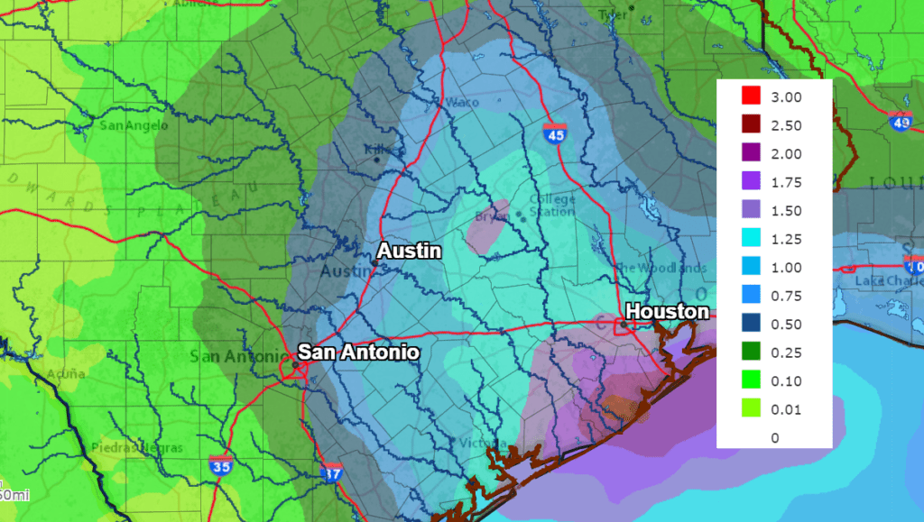
Some relief from the dry pattern is forecast next week when two separate weather systems move across the state. Each one is predicted to bring our region showers and a few thunderstorms. The first system arriving Sunday night is expected to produce widespread rain Sunday night through Monday afternoon. Totals are forecast to range from under a half inch across the Hill Country, to the around 1.5 inches across the middle Texas coast.
NWS Rainfall Forecast for the Period 6 pm Thursday through 6 pm Tuesday:
A strong cold front is forecast to sweep south through the area next Wednesday night. Forecasts call for an area of rain showers and thunderstorms to accompany the cold front, with dry and much colder temperatures to follow late next week. Totals Wednesday night are forecast to average around a quarter inch or less.
Let’s hope the rains next week are just the start of a wetter pattern as we move toward spring.
Bob
Social Media