National Hurricane Center (NHC) forecasters continue to closely monitor a strong tropical wave and low pressure system located in the central tropical Atlantic, more than a thousand miles east of the Lesser Antilles.
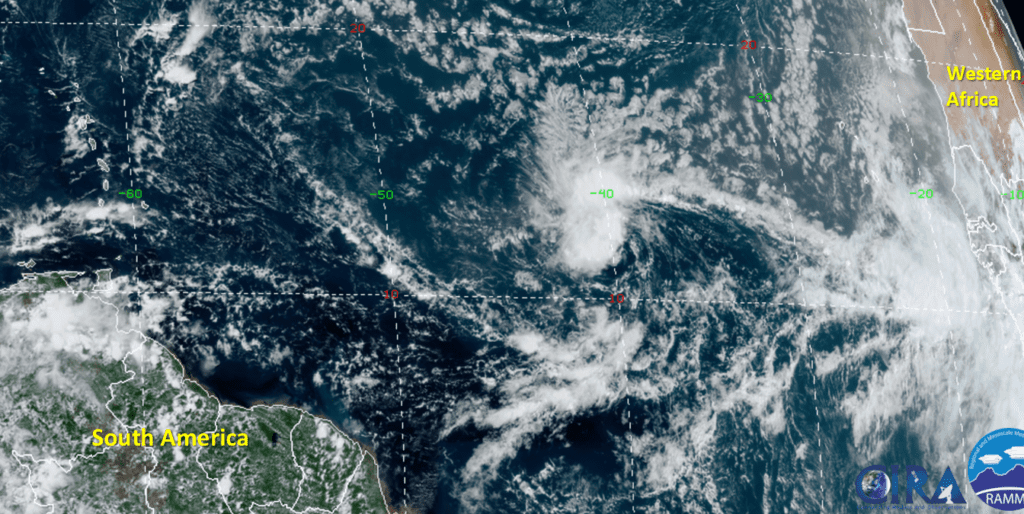
RAMMB-CIRA 08/11/2020 12:50 pm CDT
Although shower and thunderstorm activity decreased somewhat Tuesday morning, new activity was forming near the system’s center of circulation Tuesday afternoon. According to the NHC, if these storms persist, advisories will be initiated on a tropical depression Tuesday evening or Tuesday night. Even if a depression does not form by Tuesday night, a tropical depression is forecast to develop over the next couple of days as the system moves into a favorable environment. The low pressure system is moving to the west-northwest at around 15 mph and this motion is expected to continue for the next couple of days. NHC forecasters are giving this system a 90 percent chance for tropical development over the next 48 hours and the next 5 days.
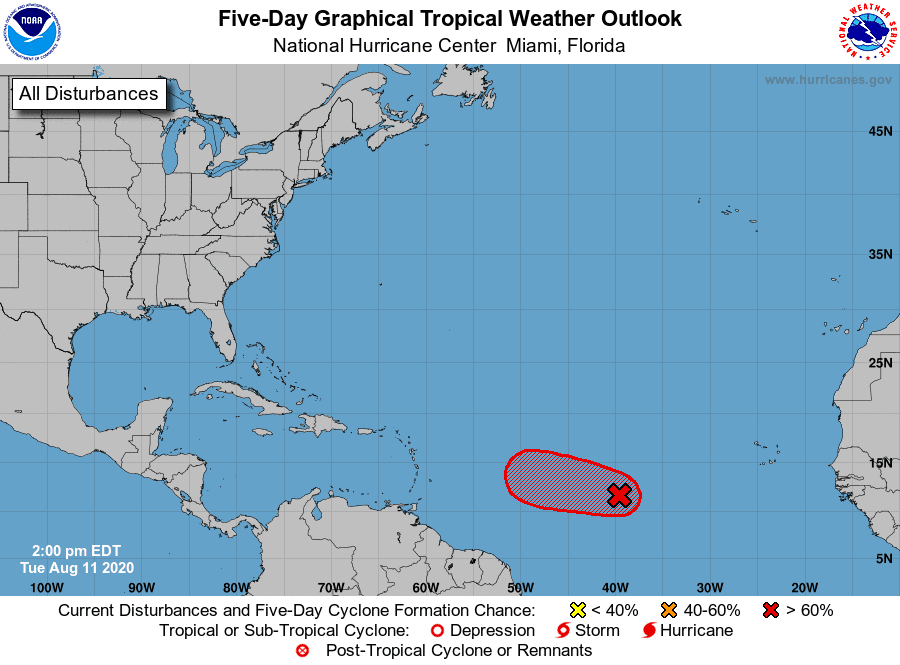
Environmental conditions are expected to become less conducive for tropical development by the end of the week when the system approaches the northern Leeward Islands. Stay tuned for further updates. The next name of the list of tropical storms and hurricanes for this year will be Josephine.
Bob
Social Media