Ingredients appear to be coming together that will bring a threat for strong to severe thunderstorms to the Hill Country, Central Texas and coastal regions Friday into Friday evening.
This morning, moisture is rapidly returning off the Gulf of Mexico, resulting in the development of widespread clouds across Central and South Texas. Surface reports indicate scattered light rain showers have begun to develop across the Rio Grande Plains, and this activity is forecast to spread northeast across our area this afternoon and evening. Rain amounts through early Friday morning are forecast to measure only a few hundredths of an inch. Areas of fog are also expected to develop late this evening and continue overnight. Today’s temperature is predicted to reach the mid and upper 60s, with low and mid-70s towards the coast. Lows Friday morning will be in the 60s.
On Friday, warmer and more humid air is expected as a warm front lifts north from the coast. A strong storm system located over the Desert Southwest is forecast to track east across West and North Texas on Friday, helping to push the dry line east out of West Texas. Forecasts call for scattered rain showers and isolated thunderstorms to develop across the region Friday morning into Friday afternoon. Some of these isolated thunderstorms may be strong to severe.
In addition, forecasters will be closely monitoring developments across the Hill Country early Friday afternoon where scattered thunderstorms are forecast to develop along the dry line. These developing storms are predicted to quickly become strong to severe. A broken line of strong to severe thunderstorms is forecast to exit the Hill Country by late afternoon, spreading to the Austin/Interstate 35 corridor in the late afternoon and early evening. The area of rain and storms is forecast to track east/southeast to the coast Friday evening into Friday night. The activity is expected to exit Central Texas by about 9 pm and the coastal region shortly after midnight.
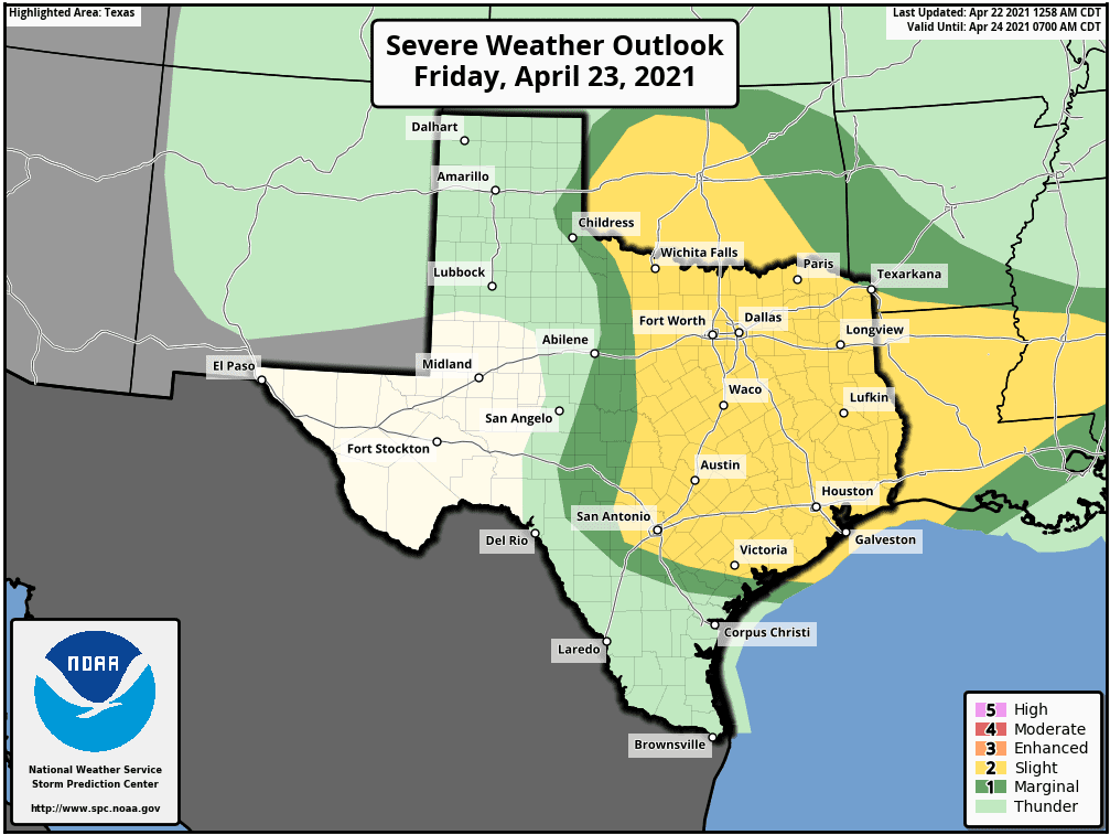
Friday’s severe storms may produce large hail up to 2 inches in dimeter and strong wind gusts to around 60 mph. In addition, there will also be a low end threat for isolated tornadoes.
The Storm Prediction Center has placed most of the region under a Slight Risk (A 2 out of 5 risk) for severe thunderstorms Friday through Friday night. The slight risk area is generally along and east of a line stretching from San Saba to Mason Kerrville. The western Hill Country has been placed under a Marginal Risk (a 1 out of 5 risk) for severe thunderstorms Friday.
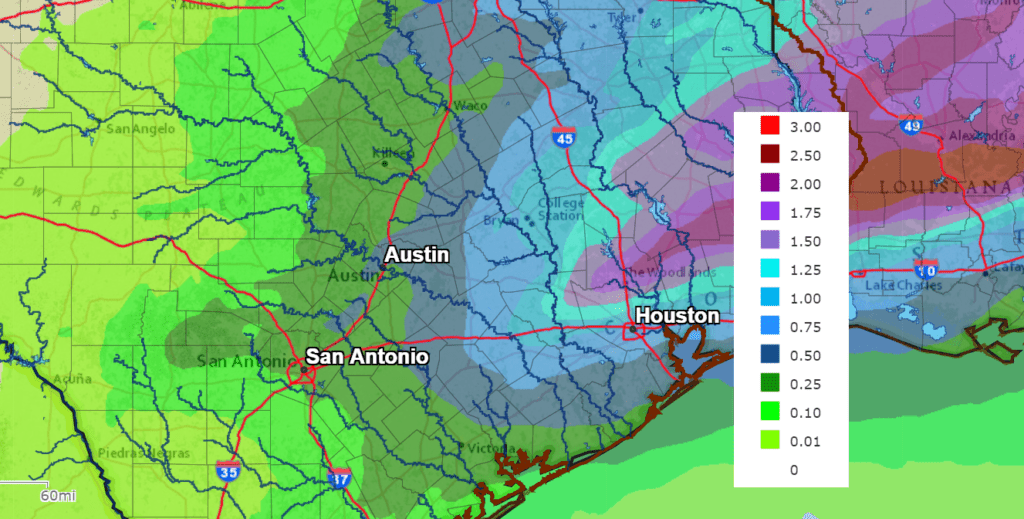
Rain totals Friday through Friday evening are forecast to be highest east of Interstate 35 and lowest across the Hill Country. The National Weather Service is forecasting general totals of a quarter to a half inch across the Hill Country and the Interstate 35 corridor, with totals of a half to one inch for areas east of Interstate 35.
All of the rain and storms are forecast to exit the region Friday night. Sunny, dry and warm weather will be in place this weekend, with high temperatures in the low and mid-80s.
Bob
Social Media