This afternoon, forecasters are closely monitoring satellite, upper-air and surface data as the dry line pushes into the Hill Country out of West Texas. Currently, there is a moderately strong capping inversion over the region that is expected to limit the development of thunderstorms. Above this inversion, the atmosphere is moist and quite unstable. If a weakness in the inversion happens to materialize, scattered thunderstorms are forecast to quickly develop and become severe. Large to very large hail and damaging wind gusts of 60-70 mph will be the primary severe weather threats. However, an isolated tornado or two cannot be ruled out. The most favored area for potential thunderstorm development this afternoon will be across the eastern Hill Country and the Austin/Interstate 35 corridor. The probability for rain will near 20-30 percent.
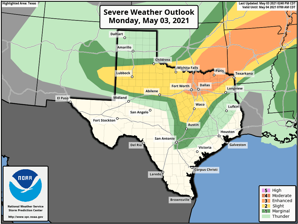
The Storm Prediction Center has placed Austin, the Interstate 35 corridor, plus Blanco, southern Burnet, eastern Llano and eastern San Saba Counties under a Marginal Risk (a 1 out of 5 risk) for severe thunderstorms through tonight. Northern Burnet, eastern Lampasas and the I-35 corridor from Georgetown to Waco have been placed under a Slight Risk (a 2 out of 5 risk) for severe thunderstorms through tonight.
Should scattered thunderstorms develop this afternoon, the activity is expected to track east of the region this evening.
There will be a second threat for scattered strong to severe thunderstorms for the eastern Hill Country and the Intestate 35 corridor toward and just after midnight tonight when a Canadian cold front presses south through the area. Atmospheric conditions will be somewhat favorable for the development of scattered thunderstorms along the front. Once again, large hail and damaging winds will be the primary severe weather threats. A line of showers and scattered thunderstorms is forecast to accompany the cold front as it sinks south to the coast overnight.
Rain amounts from potential scattered storms this afternoon are forecast to average between a quarter and a half inch, with isolated totals to near 1 inch possible. Rain amounts from scattered showers and storms overnight are forecast to average around a quarter inch.
Sunny and slightly cooler weather is forecast Tuesday and Wednesday, with high temperatures around 80 degrees. Sunny and warmer weather will continue Thursday through the upcoming weekend.
Bob
Social Media