Springtime storms are beginning to become a part of our forecast as temperatures warm and the cool air of winter begins retreating north. Even though it’s still almost a week away, the Storm Prediction Center is monitoring the potential for widespread strong to severe storms across a large part of Texas next Monday.
Forecasts call for a robust trough of low pressure to track from the Desert Southwest, through Central and North Texas next Monday into Tuesday. Significant moisture will be returning off the Gulf leading to the development of thunderstorms. But in addition, forecast solutions are already indicating there will be a turning of the winds with height in the atmosphere. This shear may play a big role in the development of severe or possibly supercell thunderstorms.
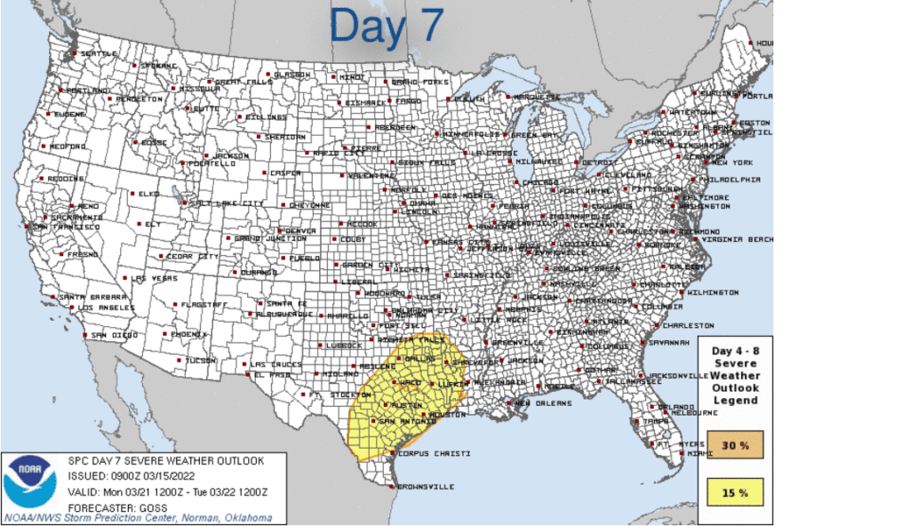
The Storm Prediction Center (SPC) has placed the Hill Country along with Central, and Southeast Texas under 15 percent risk for severe thunderstorms next Monday. According to SPC, this is shaping up to be an all-hazards severe weather event — including potential for tornadoes! Confidence in this potential threat for severe thunderstorms is expected to increase over the next couple of days as model solutions hone in on the event.
In addition to the threat for severe storms, the approaching trough of low pressure is predicted to bring our region some much needed rain. Tuesday’s forecasts were calling for 2-day totals of 0.25-0.5 inches across the Hill Country, and between 0.5 and 1 inches for areas east of Interstate 35. This forecast will be refined as we get closer to the event.
Stay tuned over the next few days for important updates on this upcoming potentially stormy and wet period.
Bob
Social Media