Tropical Depression Seven formed late Wednesday morning in the west-central tropical Atlantic, to the east of the Leeward Islands. At this point, the tropical depression is not a threat to the Gulf of Mexico. But it is early in the forecast cycle and the progress of the system will need to be watched closely over the coming days.
Wednesday afternoon’s satellite imagery showed the circulation associated the tropical depression has recently become better defined. The system’s associated thunderstorm activity persisted overnight and this morning, and although most of the storms are confined to the eastern portion of the circulation, it now has enough organization for the National Hurricane Center to classify the system as a tropical depression.
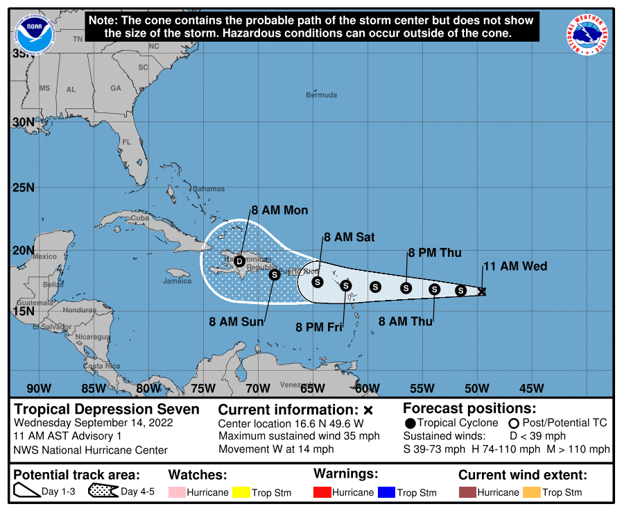
As of late Wednesday morning, the tropical depression was centered about 805 miles east of the Leeward Islands. The depression was moving toward the west near 14 mph, and this general motion is expected to continue during the next few days. On the forecast track, the center of the system is forecast to move through the Leeward Islands on Friday or Friday night and be near the Virgin Islands and Puerto Rico this weekend. Maximum sustained winds are near 35 mph with higher gusts. Some gradual strengthening is forecast during the next day or so, and the depression is forecast to become a tropical storm either tonight or Thursday.
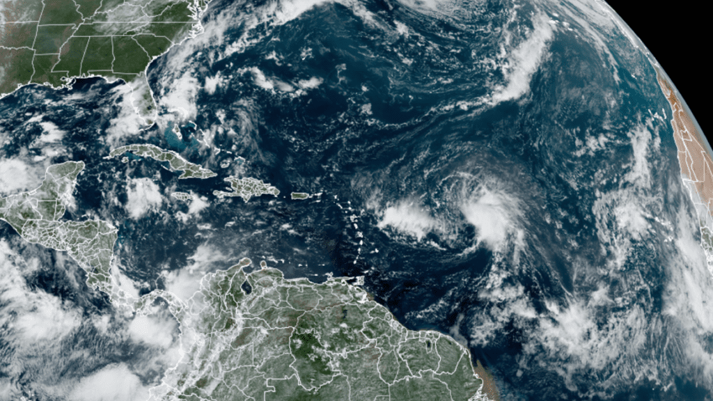
NOAA/Colorado State University/RAMMB 09/14/2022 12:30 pm CDT
The National Hurricane Center’s five-day forecast tracks calls for the system to move west and be near Puerto Rico Saturday, then move near or over Hispaniola Sunday into Monday. Beyond this point there is considerable uncertainty as to whether the system will even survive after crossing the mountains of Hispaniola. It the system does survive, a trough along the East Coast could eventually pull it to the north. At the same time, however, a broad ridge of high pressure over the south central U.S. could help steer the system more to the west.
Forecasters should begin to get a better handle on the future track and intensity of the system over the next couple of days.
I want to state there is nothing to get alarmed about at this point. The system doesn’t pose a threat to the Gulf of Mexico anytime in the near future. Stay tuned for additional forecasts and updates.
Bob
Social Media