Afternoon satellite imagery indicates convection associated with an area of low pressure area over the central tropical Atlantic has become better organized. Since the system is about 48 hours away from the Lesser Antilles and is expected to become a tropical storm before reaching the islands, the National Hurricane Center began issuing advisories on this potential tropical cyclone late this afternoon.
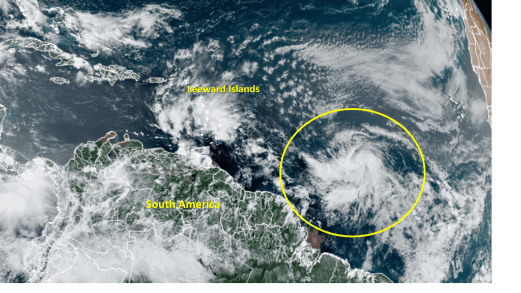
As of 4:00 pm CDT, the tropical disturbance was centered about 1195 miles east of the Windward Islands. The system was moving toward the west-northwest near 21 mph and this motion is expected to continue with an increase in forward speed during the next couple of days. On the forecast track, the system is expected to pass near or over portions of the Windward Islands or the southern Leeward Islands on Friday, move into the eastern Caribbean Sea late Friday and Friday night, then move near the southern coast of Hispaniola on Saturday.
By about Saturday, the system is expected to approach a weakness in the subtropical ridge over the southwestern Atlantic. This should cause the system to slow its forward speed and turn more northwestward in the direction of the eastern Gulf of Mexico. The track guidance become more diverse during this time in regards to how far north the system will turn. It doesn’t appear the system will track toward the western Gulf of Mexico. But it’s way too early to have strong confidence in this forecast just yet. The track forecast is more uncertain than usual right now since the system does not yet have a well-defined center.
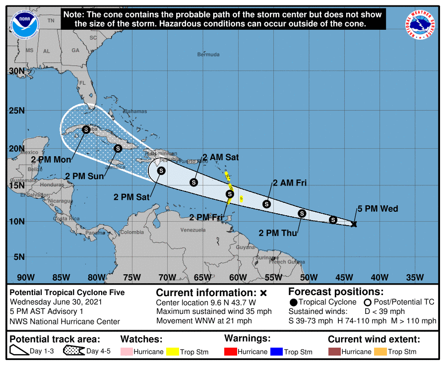
Maximum sustained winds are near 35 mph with higher gusts. Some strengthening is forecast during the next 48 hours and the disturbance is expected to become a tropical storm Wednesday night or on Thursday. NHC forecasters are giving this system a high chance, (a 70 percent chance), for tropical development over the next 48 hours. Should the disturbance reach tropical storm strength, it will be given the name Elsa.
I will pass along additional information on the potential tropical cyclone and increasing rain chances for the holiday weekend and next week in a Thursday update.
Bob
Social Media