The tropical depression that was located east of the Leeward Islands late Wednesday strengthened Wednesday night to become Tropical Storm Fiona.
As of mid-afternoon Thursday, tropical storm Fiona was located in the tropical Atlantic, about 425 miles east of the northern Leeward Islands. Fiona is a struggling tropical storm due to strong westerly winds in the middle atmosphere that are displacing the storm’s clouds and thunderstorms to the east of the low-level center. Data from an Air Force Reserve Hurricane Hunter aircraft investigating the storm found maximum sustained winds near 60 mph, with higher gusts. Little change in strength is forecast during the next few days.
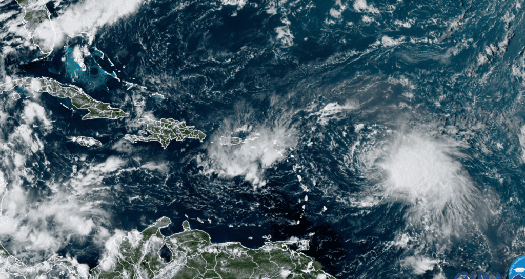
NOAA/Colorado State University/RAMMB 09/15/2022 2:10 pm CDT
Fiona is moving toward the west near 14 mph. A westward motion with some decrease in forward speed is expected through Saturday night, with a turn toward the west-northwest possible on Sunday. On the forecast track, the center of Fiona is expected to move across the Leeward Islands Friday night and early Saturday, and move near the Virgin Islands and Puerto Rico late Saturday into Sunday.
Beyond Sunday, there is considerable uncertainty in the forecast path for Fiona. However, looking at the various forecast solutions from Thursday morning, it appears much less likely now Fiona will track west into the Gulf of Mexico. The majority of solutions call for Fiona to turn to the northwest and north, reaching a position east of the Bahamas early next week. A weakness in the subtropical ridge located over the western Atlantic is predicted to be sufficiently strong enough to pull Fiona up to the northwest and north. However, the solutions are currently split as to whether Fiona will come far enough west to affect portions of the East Coast, or remain out over the open Atlantic late next week.
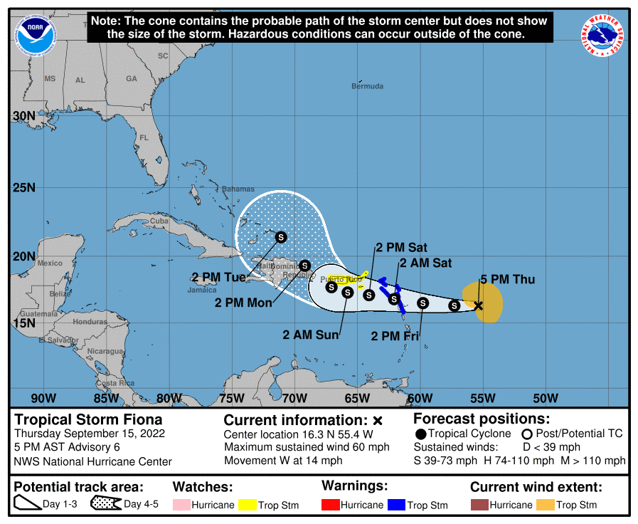
For interests across the western Gulf of Mexico and along the Texas coast, the likelihood Fiona will track into the Gulf of Mexico next week have decreased significantly from earlier projections.
The rest of the tropical Atlantic, Caribbean Sea, and the Gulf of Mexico is currently quiet and there are no systems in place which pose a threat for tropical development over the next few days.
It is shaping up to be a hot week across Texas next week. The temperature is forecast to climb to the upper 90s most of the week. And a triple-digit temperature is not completely out of the question. I’ll have more details in Friday’s report.
Bob
Social Media