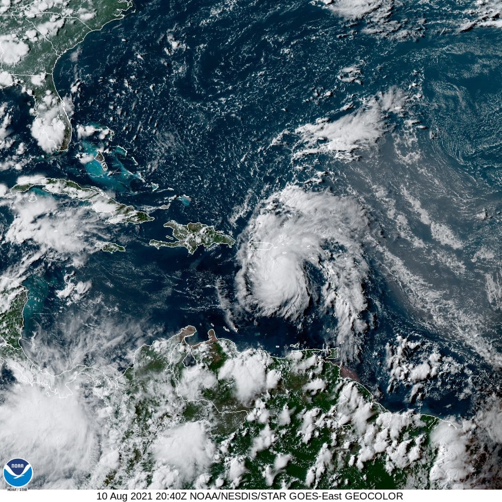
Tuesday afternoon satellite imagery continued to show a strong tropical disturbance having an organized convective pattern, with satellite derived intensity estimates of tropical-storm strength. However, the circulation still appeared to not be well defined, with the San Juan WSR-88D Doppler radar showing multiple mid-level centers and several convective cells with small-scale rotation. Based on this data, the National Hurricane Center is not planning to upgrade the system to a tropical cyclone just yet and will continue to be called Potential Tropical Cyclone Six. The NHC uses the designation of “Potential Tropical Cyclone”, when a disturbance is not yet a tropical cyclone, but poses a threat of bringing tropical storm or hurricane conditions to land areas within 48 hours.
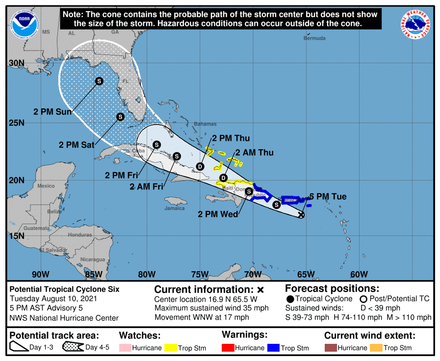
As of 4 pm CDT Tuesday, the tropical disturbance was centered over the eastern Caribbean Sea, about 105 miles east-southeast of Ponce, Puerto Rico. The system is moving toward the west-northwest near 17 mph and this general motion is expected to continue during the next few days. On the forecast track, the disturbance is expected to pass near or over the U.S. Virgin Islands and Puerto Rico tonight, be near or over Hispaniola on Wednesday, and be near the southeastern Bahamas and the Turks and Caicos Islands on Thursday.

Maximum sustained winds are estimated to be near 35 mph with higher gusts. Gradual strengthening is forecast during the next day or so and the disturbance is expected to become a tropical storm Tuesday night. Some weakening is likely while the system interacts with Hispaniola on Wednesday.
The NHC forecast track for Tropical Cyclone Six has changed little since yesterday and remains near the various consensus model solutions. The forecast calls for the system to track just north of Cuba Thursday into Friday, entering the Florida Straits early Saturday. The system is predicted to move to the eastern Gulf of Mexico Saturday through Sunday, eventually taking aim on the southeastern U.S.

Because of a weakness in the high pressure ridge over the southeastern U.S., Potential Cyclone Six remains no direct threat to the Texas coast at this time. But this is a reminder that the peak of hurricane season is coming up over the next month and everyone needs to keep a close watch on tropical developments in the coming weeks.
Bob


Social Media