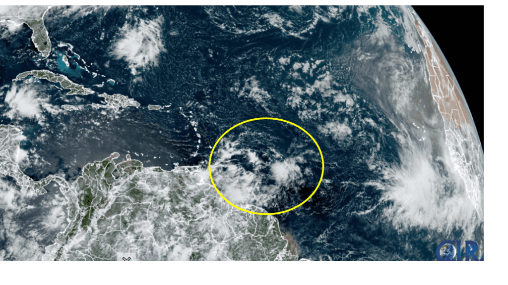
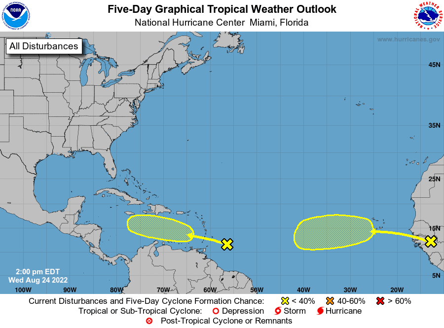
National Hurricane Center forecasters are closely monitoring a tropical wave located a few hundred miles east-southeast of the Windward Islands. This system is producing a large area of disorganized shower and thunderstorm activity. According to the NHC, environmental conditions could become more conducive for slow development of this system in several days after the wave crosses the Windward Islands. The system is predicted to move across the eastern and central Caribbean Sea late this week into early next week. So far, the NHC is giving this system a low chance, just a 20 percent chance, for tropical development over the next 5 days.
NOAA/Colorado State University/RAMMB 08/24/2022 12:40 pm CDT
NHC forecasters are also watching way out over the far eastern Atlantic where a tropical wave is forecast to move off the west coast of Africa in the next day or so. Environmental conditions could support some slow development of this system late this week or over the weekend while it moves westward at 10 to 15 mph. The NHC is giving this system a low chance, just a 20 percent chance for tropical development over the next 5 days.
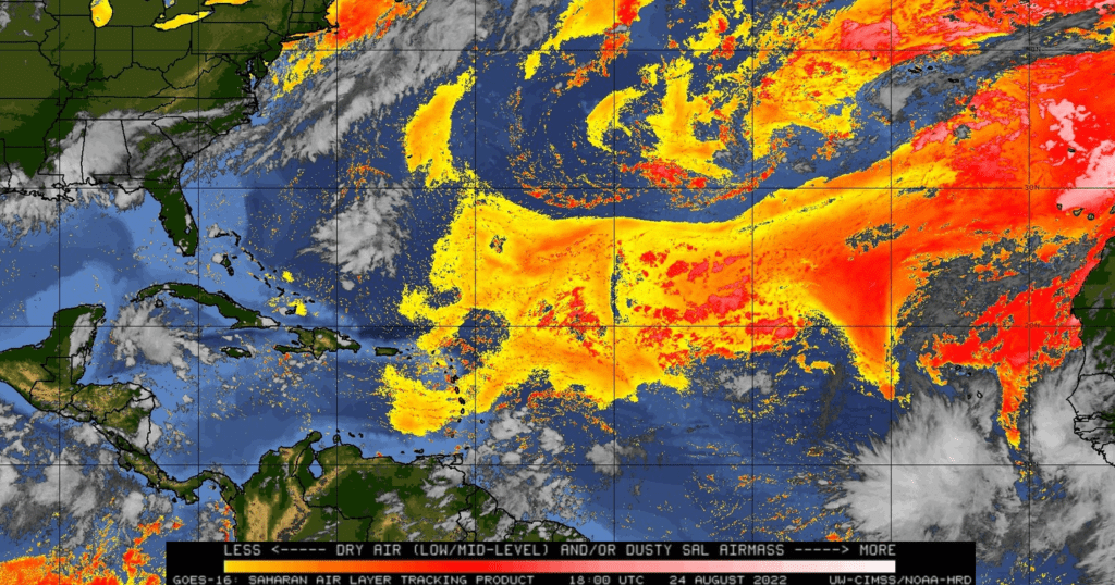
A Wednesday afternoon Atlantic satellite image showed considerable dry air and some Sahara dust still covering much of the central and eastern Atlantic, generally to the north of 15 degrees latitude, and generally to the east of 60 degrees longitude. This dry air is keeping some of the tropical waves moving off Africa from developing. It’s a bit unusual for the dry air and dust to still be in place this late into August.
Bob
Social Media