A heads up for big changes in the weather that will be taking place Friday when a strong cold front punches through our area Friday morning into Friday afternoon.
Today will be the last really mild day we’re going to see for some time as changes in the position of the jet stream will bring colder/cooler temperatures to our region for at least the next couple of weeks. A large trough of low pressure currently pushing east across the northern and central Rockies is going to help push a strong Canadian cold front through Texas Thursday night and Friday. Forecasts call for the cold front to move across the Hill Country region in the hours just before or just after sunrise Friday. The front is predicted to move across the Austin/Interstate 35 corridor mid-morning and the coastal plains region in the early afternoon.
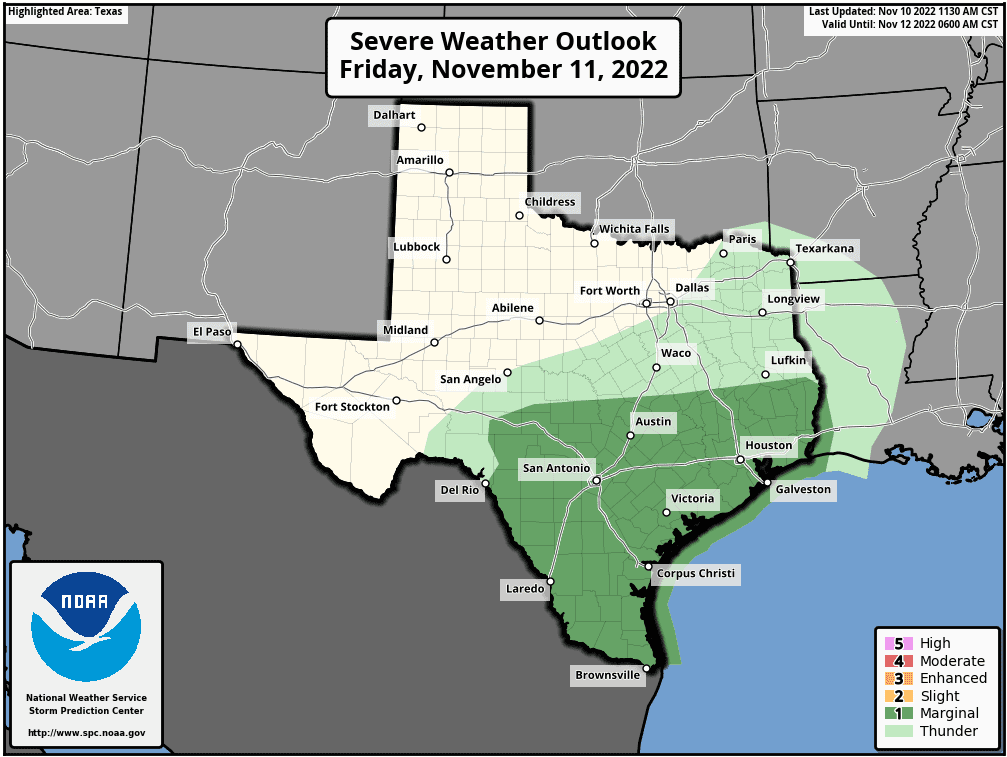
Widespread light to moderate rain showers and scattered thunderstorms are forecast to develop along and behind the cold front as good atmospheric lift spreads over our area. High-resolution forecasts indicate atmospheric conditions will be marginally favorable for the development of a few strong to possibly severe thunderstorms. The primary severe weather threat will be large hail. The Strom Prediction Center has placed the Austin/Central Texas region, the middle Texas coast, and most of the Hill Country under a Marginal Risk (a 1 out of 5 risk) for severe thunderstorms on Friday.
The rain is predicted to taper off from west to east across the region Friday afternoon. The rain should end across the coastal region early Friday evening.
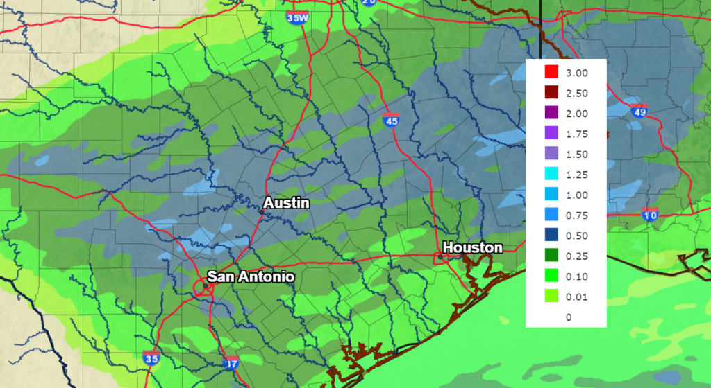
Rain amounts Friday are forecast to generally average between 0.25 and 0.5 inches, with isolated totals of 0.5 to 1 inch possible—especially across the Hill Country and Central Texas regions.
NWS Rainfall Forecast for the Period 6 pm Thursday through 6 pm Saturday:
Much cooler temperatures will follow the cold front Friday morning through Friday afternoon. By Friday afternoon, readings are forecast to fall into the 40s across the Hill Country, into the low and mid-50s across Central Texas, and into the 70s and 60s across the coastal plains. Expect a strong north wind at 10-20 mph Friday and Friday night. Wind speeds should decrease to 10-15 mph Saturday. Sunny weather is predicted for Saturday and Sunday.
Do note the temperature could dip close to freezing across parts of the Hill Country late Friday night and Saturday night.
- Lows Saturday morning will include the low and mid-30s across the Hill Country, the upper 30s to 40 degrees across Central Texas, and the low to mod-40s towards the coast.
- High temperatures Saturday and Sunday will generally be around 58-60 degrees
- Lows Sunday morning will include the low and mid-30s across the Hill Country, the mid and upper 30s across Central Texas, and the low to mid-40s across the coastal plains.
- Lows Monday morning are forecast to be mid-40s to low 50s.
I’ll pass along another weather update Friday.
Bob
Social Media