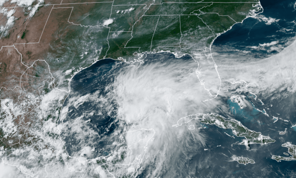
As of late Thursday afternoon, visible satellite images showed that the cloud pattern associated with the broad area of low pressure located over the southwestern Gulf of Mexico has gradually becoming better organized. Deep convection has begun to form a broad curved band over the eastern portion of the system, similar to what one might see in a developing subtropical cyclone.
Colorado State University/RAMMB 06/17/2021 4:10 pm CDT
Although the upper-level winds are not particularly favorable for development, with lots of westerly shear over the area, the global models do suggest tropical/subtropical cyclogenesis within the next 12 hours or so. Given the proximity of the disturbance to land, the National Hurricane Center began initiating advisories on the potential tropical cyclone. Both satellite derived wind products and the early afternoon USAF mission confirm that system has a broad low pressure center over the south-central Gulf of Mexico with winds generally in the 25 kt range. The current organizational structure is that below what is classifiable as a tropical cyclone.
At 4:00 PM CDT, the tropical disturbance was centered over the west-central Gulf of Mexico, about 475 miles south of Morgan City, Louisiana. The system was moving toward the north near 9 mph and this motion with some increase in forward speed is expected for the next day or so. On the forecast track, the system will approach the north-central Gulf Coast late Friday or early Saturday. A northeastward motion across the southeastern United States is likely after landfall. Maximum sustained winds are near 30 mph with higher gusts. Some strengthening is forecast tonight and Friday.
The National Hurricane Center indicates a subtropical or tropical depression or storm is likely to form over the west-central Gulf of Mexico Thursday night or early Friday, with the probability for development at 90 percent.
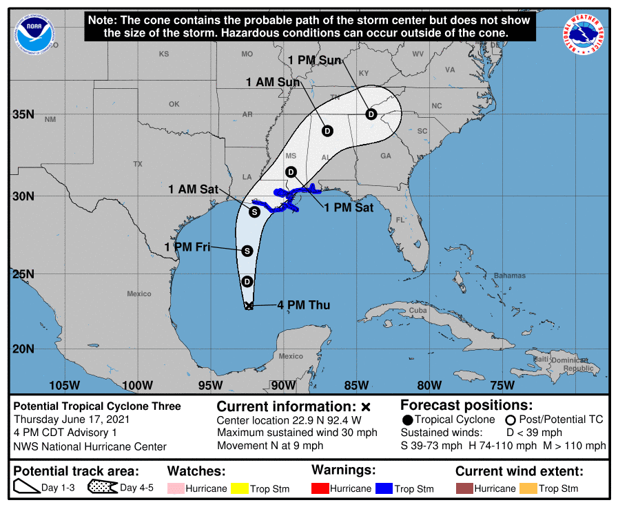
Based on the latest information and forecast track, any impacts to Southeast Texas and the middle Texas coast are expected to be minimal, with some increase in coastal tides, likely below levels that would cause any significant coastal flooding and an increase in showers near and east of Galveston Bay.
Bob
Social Media