…A Hurricane Watch is in effect from Port Aransas to San Luis Pass Texas…
…A Tropical Storm Warning is in effect from the Baffin Bay to Sabine Pass…
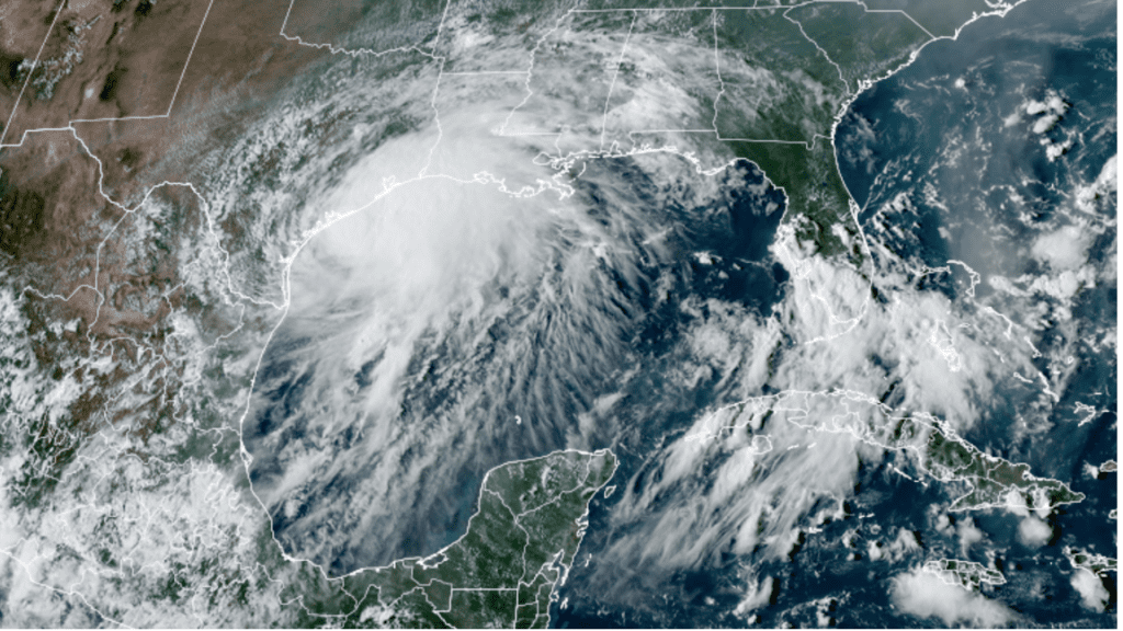
Doppler radar data from Brownsville and Corpus Christi, along with reconnaissance aircraft wind data Monday afternoon indicated Nicholas’ inner-core structure underwent some radical changes since early morning, with the old low-level center dissipating. There now appears to be three tight centers revolving counterclockwise around a mean center.
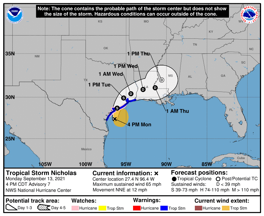
As of 4 pm CDT, the center of Tropical Storm Nicholas was estimated to be about 70 miles south of Port Oconnor, Texas, or about 85 miles south-southwest of Matagorda, Texas. Nicholas was moving toward the north-northeast near 12 mph and this general motion is expected to continue through tonight, followed by a turn toward the northeast by late Tuesday.
Data from NOAA Doppler weather radars and an earlier reconnaissance flight indicate that maximum sustained winds have increased to near 65 mph with higher gusts. Some additional strengthening is forecast this afternoon and evening, and Nicholas could be near hurricane strength when it reaches the central Texas coast. Weakening is anticipated on Tuesday and Wednesday while Nicholas moves over land.
The National Hurricane Center’s forecast track calls for the center of Nicholas to make landfall along the middle Texas coast Monday night. The center of the storm is predicted to be near Houston by midday Tuesday, reaching a position northwest of Beaumont as a tropical depression around midnight Tuesday night.
Rainfall:
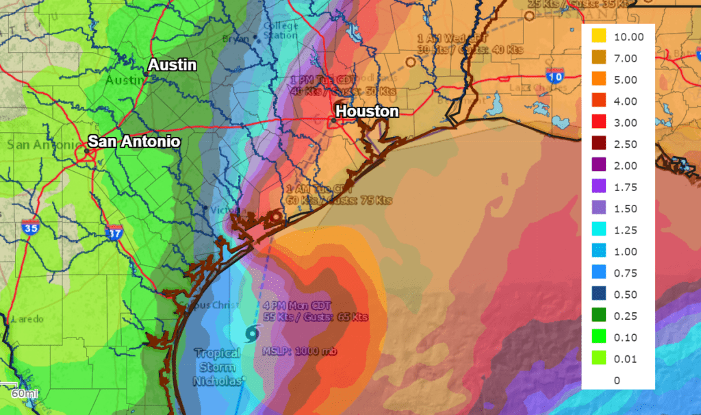
Bands of light to moderate rain associated with the outer circulation of Nicholas began pushing inland along the middle and upper Texas coast Monday morning. Moderate to heavy rain will begin spreading across the coastal plains Monday evening, with the rain continuing through Tuesday morning. Rainfall rates of 2-4 inches per hour will be possible.
Across Central Texas and the eastern Hill Country, mostly light showers are forecast to spread north across the area Monday night through Tuesday.
Wednesday through Friday, lingering tropical moisture following Nicholas will cause a 30-40 percent chance for mainly scattered afternoon rain showers and thunderstorms across Central Texas and the middle Texas coast.
Significant rainfall is expected along and east of the track of Nicholas. There will be a sharp gradient, with significantly lower totals expected to the west of the path of Nicholas.
The National Weather Service’s 5-day rainfall forecast, calls for totals of 8-12 inches for locations along and south of U.S. Highway 59. Between Columbus and Wharton, totals of 4-6 inches are forecast. Between La Grange and Columbus, totals of 1 and 3 inches are forecast. Further inland, considerably lower totals are forecast.
NWS Rainfall Forecast for the Periods 7 pm Monday through 7 pm Saturday:
Winds:
Tropical storm force winds are likely along the coast, from Matagorda to Galveston Bay and inland to the US 59 corridor. Sustained winds in the 65-75 mph range will be possible over the Matagorda Bay region northward into Jackson and possibly southern Wharton Counties. Sustained tropical storm force winds are forecast to spread into Wharton and Colorado Counties Monday night into Tuesday morning. Winds in excess of 40 mph will be possible across Fayette County late Monday night into Tuesday morning.
NOAA/Colorado State University/RAMMB 09/13/21 4:10 pm CDT
Bob
Social Media