Very hot temperatures will continue throughout the week, but it appears the hottest of the temperatures of the week are now behind us. Tuesday’s forecast data calls for the center of the heat dome to remain across the Four Corners region for the rest of this week and through the upcoming weekend. With less influence expected over the coming days, high temperatures are predicted to slowly edge down a few degrees.
- High temperatures across the Hill Country and Central Texas regions are forecast to be near 102-105 degrees Wednesday and Thursday, lowering to about 100-102 degrees Friday and this weekend.
- For the coastal plains region, expect a high temperature near 100 degrees Wednesday and Thursday, lowering to the upper 90s Friday and this weekend.
Isolated thunderstorms are forecast to continue across the region Wednesday through Friday due to a couple of weak boundaries/wind shift lines in the region. The chance for rain at any given location will be less than 20 percent. Most areas will likely stay dry, but a few lucky spots could see spotty totals to around a half inch.
Sunny and dry weather is predicted for the weekend.
Regarding tropical weather, National Hurricane Center forecasters are monitoring a couple of weak low pressure systems embedded along a surface trough over the northern Gulf of Mexico. These features are producing a large area of disorganized showers and thunderstorms, with some of the activity now spreading inland over the Florida Panhandle. The surface trough is expected to meander near the northern Gulf coast through the end of the week, and gradual development will only be possible if the system remains over water during that time. Regardless of development, heavy rains will pose a risk of flash flooding along portions of the northern Gulf coast from Louisiana to the Florida Panhandle over the next several days.
Most forecasts call for the system to slowly move to the northeast late this week, having no impact on Texas weather.
National Hurricane Center forecasters have lowered the probability for tropical development over the next 5 days from 30 percent to 20 percent.
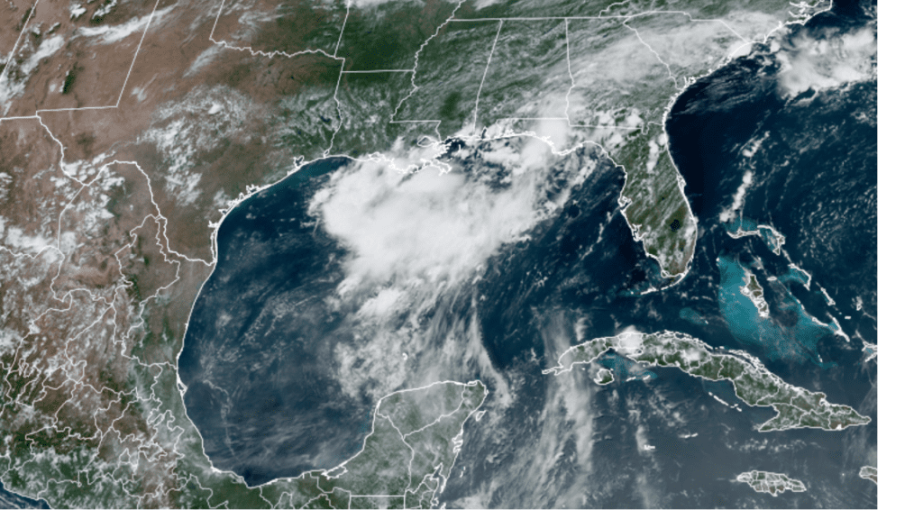
NOAA/Colorado State University/RAMMB 07/12/2022 1:18 pm CDT
July’s Full Buck Moon
July’s full Buck Moon will occur Wednesday, July 13 at 2:38 pm CDT. Look towards the southeast sky after sunset Tuesday and Wednesday evenings to watch it rise into the sky. July’s full Buck Moon will orbit closer to Earth than any other full Moon this year, making it the biggest and brightest supermoon of 2022! At its nearest point, the Buck Moon will be 222,089.3 miles (357,418 km) from Earth so it will just edge out June’s Strawberry Moon by 200 km.
Bob
Social Media