With light northeasterly winds forecast across our region Thursday, the Central Texas Clean Air Force has issued an Ozone Action Day for the Austin area for Thursday, August 20th. Atmospheric conditions will be favorable for producing high levels of ozone pollution. The Clean Air Force recommends walking or riding the bus, taking your lunch to work and conserving energy to hold down ozone levels.
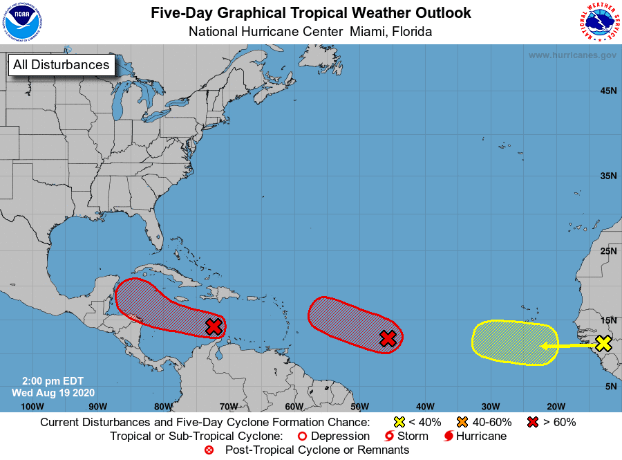
Forecasters continue to closely monitor a strong tropical wave located over the central Caribbean Sea. Showers and thunderstorms associated with the wave have become more concentrated today. National Hurricane Center forecasters indicate some gradual development of this system is possible over next day or so while it moves westward at about 15 to 20 mph across the central Caribbean Sea. After that time, the wave is forecast to move more slowly and a tropical depression is likely to form later this week, at about the time the system reaches the northwestern Caribbean Sea. The NHC is giving this system an 80 percent chance for development over the next 5 days.
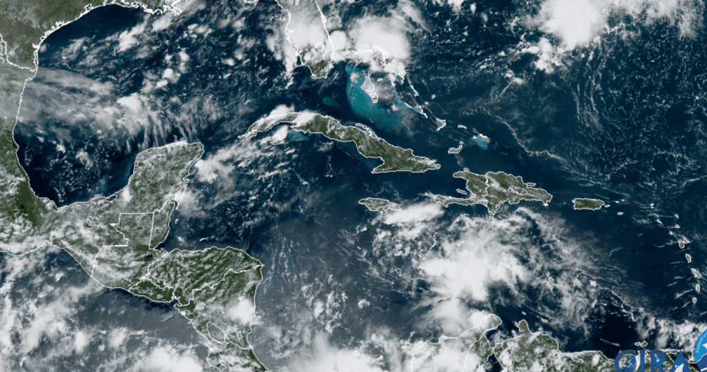
RAMMB-CIRA 08/19/2020 1:30 pm CDT
Over the weekend into early next week, model guidance continues to greatly divergence on what will eventually happen with this disturbance. Over the weekend, the disturbance will likely be over the northwest Caribbean Sea or entering the southern Gulf of Mexico. How quickly the system develops and moves will determine its steering pattern over the Gulf of Mexico. A faster and stronger system would likely track more toward the north, potentially toward the central or northeastern Gulf of Mexico. Meanwhile, a weaker and slower system would likely track more toward the western/northwestern Gulf of Mexico. Right now, I am giving a bit more confidence to the weaker and slower system scenario, bringing a tropical system into the western Gulf by the early to middle part of next week. It is still way too early to speculate on a possible path towards the Texas coast. We should get a better handle on the forecast over the next 2-3 days.
The National Hurricane Center is tracking two other strong tropical waves in the central and eastern tropical Atlantic. Both of these systems will need to be closely monitored over the next several days.
I’ll pass along another update on Thursday.
Bob
Social Media