Quiet weather conditions are in place across the region as we close out the workweek. There’s a feel of early summer in the air, with the warm temperatures and very humid conditions. This early summer weather is expected to continue through the weekend.
Friday started off with widespread clouds as stiff southerly breezes pulled very humid air north from the Gulf of Mexico. These clouds are forecast to thin this afternoon, leading to breaks in the clouds and scattered sunshine. A strong pressure gradient between an area of high pressure along the East Coast and an area of low pressure over the northern Plains states is expected to cause strong and gusty winds this afternoon, tonight Saturday, and Sunday. Expect southerly winds with speeds of 10-20 mph and gusts to 30 mph through the period. High temperatures Friday afternoon are forecast to be mostly in the mid-80s. Cloudy, breezy, and warm conditions are forecast Friday night. Lows Saturday morning are forecast to be in the mid and upper 60s.
More early summer-like weather can be expected across the region Saturday. Morning clouds will give way to scattered sunshine in the afternoon. It will be quite breezy and warm, with temperatures climbing to the mid and upper 80s. Attention late Saturday afternoon will be focused out west across the Edwards Plateau and the Concho Valley regions. Here, the West Texas dry line is predicted to set up in the late afternoon. Weather conditions appear somewhat favorable for a few scattered thunderstorms to develop along the dry line, with the storms forecast to track east to the western and northern Hill Country—the area between Junction, Brady and Brownwood. Some of these storms will have the potential to become strong to severe. The Strom Prediction Center has placed this area under a Marginal Risk (a 1 out of 5 risk) for severe thunderstorms Saturday afternoon through 7 am Sunday. Large hail and damaging winds will be possible with the developing thunderstorms. The storms are predicted to diminish as they push further east into the Hill Country Saturday night.
For the majority of the Hill Country, Central Texas and coastal regions, quiet weather is forecast Saturday night. Lows Sunday morning will be in the upper 60s.
An unsettled weather pattern is forecast to take shape across the Hill Country and the Interstate 35 corridor Sunday afternoon and Sunday night when a Pacific cold front from the southern Rockies sags southeast into Northwest Texas. The front is forecast to reach the Big Country and Edwards Plateau areas Sunday evening, then slowly sink southeast through Hill County Sunday night and the Central Texas and coastal regions Monday. Atmospheric conditions are forecast to be favorable for the development of widespread rain showers and scattered thunderstorms ahead of, along, and behind the cold front. There will be a chance for some of the thunderstorms to be strong to severe. The Storm Prediction Center has placed the Hill Country and parts of the Interstate 35 corridor, including Austin, under a Marginal Risk (a 1 out of 5 risk) for severe thunderstorms Sunday afternoon through 7 am Monday. The risk area is generally west of a line stretching from Rockdale, to Austin, and San Antonio. The primary severe weather threats will be large hail and damaging downburst winds.
- For the Hill Country region, expect a 50-60 percent chance for rain showers and scattered thunderstorms Sunday afternoon, followed by a near 100 percent chance for rain and thunderstorms Sunday night through Monday afternoon. Mainly light rain can be expected Monday afternoon. The rain should taper off Monday evening.
- For the Austin and Central Texas regions, there will be a 20-30 percent chance for scattered rain showers and thunderstorms Sunday afternoon, followed by a near 100 percent chance for rain and storms beginning around midnight Sunday night, continuing through Monday afternoon. The rain should taper off Monday evening.
- For the middle Texas coast, expect a partly cloudy sky Sunday afternoon and Sunday night. The chance for rain and thunderstorms will increase late Monday morning through Monday afternoon, with the best chance for rain occurring Monday evening. The rain should taper off after midnight Monday night as the cold front pushes into the Gulf.
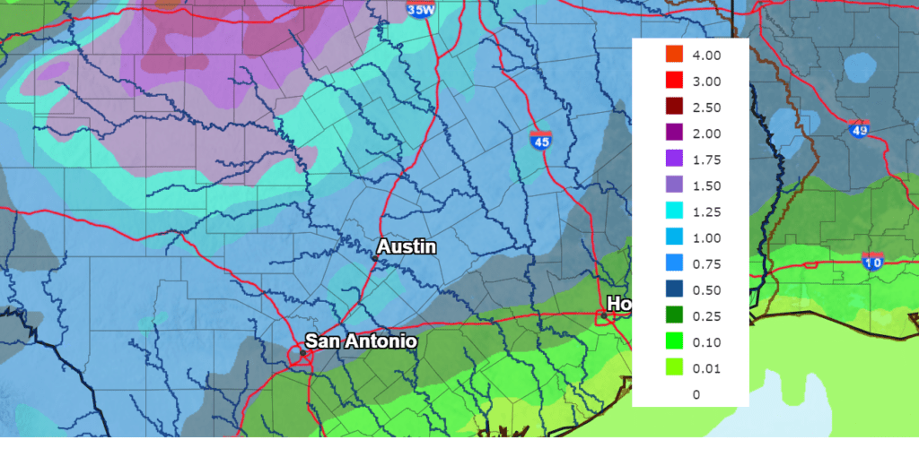
Rain amounts from the rain and storms are forecast to be heaviest across the northern Hill Country, and lowest towards the middle coast. The National Weather Service is forecasting 2-day totals of near 1.5 to 2 inches across the northern Hill Country. Across the rest of the Hill Country and the Austin/Interstate 35 corridor, totals are forecast to be close to 1 inch. And for the middle Texas coast, totals are forecast to range between a tenth and a half inch.
NWS Rainfall Forecast for the Period 7 am Friday through 7 am Wednesday:
Sunny and dry weather will return to the area Tuesday and is predicted to continue through next Friday. Temperatures are forecast to be a little cooler Monday through Wednesday behind the cold front. But noticeably warmer readings are forecast to return next Thursday and Friday.
- High temperatures are forecast to be in the mid and upper 70s Monday and Tuesday, warming to around 80 degrees Wednesday.
- High temperatures Thursday and Friday are predicted to be in the upper 80s.
- Lows Tuesday and Wednesday mornings are forecast to be in the 50s.
- Lows Thursday through Saturday morning are forecast to be in the 60s.
Dry and even warmer weather is forecast for next weekend, with high temperatures expected to be around 90-92 degrees. Long-range solutions show the next chance for rain to occur sometime around May 3rd or 4th. Stay tuned.
Happy Earth Day
Today, April 22, 2022, is Earth Day, a time set aside to celebrate the Earth, learn about the environment, and promote conservation. The theme for this year’s event is “Invest in Our Planet.” NASA will be holding a virtual on-line event celebrating our planet. The event will include live talks, live games, a chat with scientists and a fun zone-learning zone. The event will run from 9 am till 3 pm CDT. Register at go.nasa.gov/EarthDayEvent2022
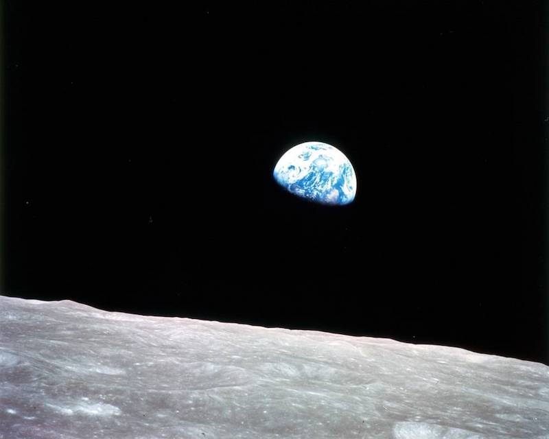
Image courtesy NASA
Have a good weekend.
Bob
Social Media