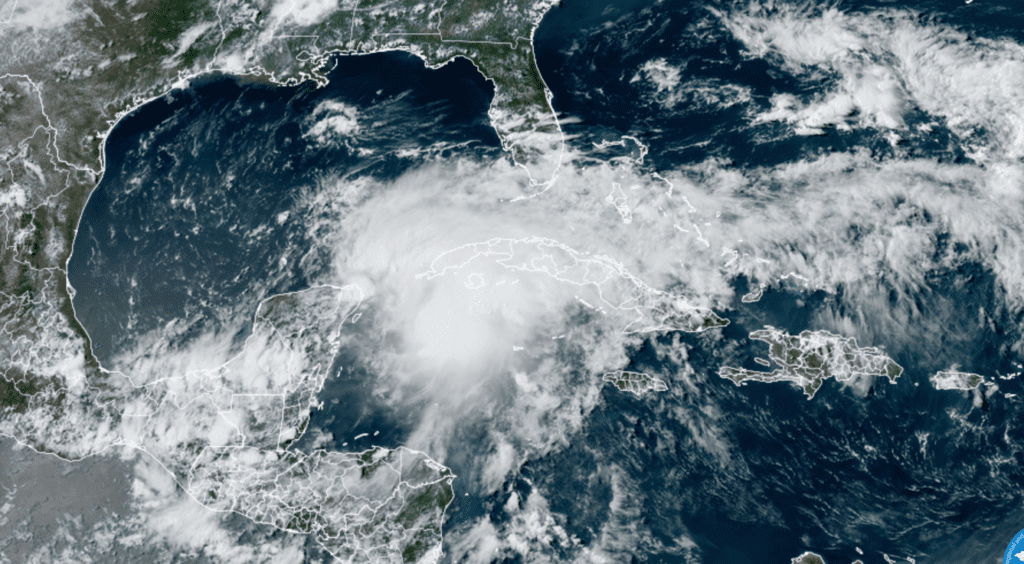
Satellite imagery, surface observations, and reports from an Air Force Reserve Hurricane Hunter aircraft show that a broad low pressure area is centered over the northeastern part of the Yucatan Peninsula of Mexico. The system is currently producing poorly organized convection in the northeastern quadrant due to the effects of 20-30 kt of southwesterly vertical wind shear. Due to the possibility that the system could become a tropical storm with impacts in the Florida Keys, and portions of the Florida Peninsula and western Cuba, advisories have been initiated on Potential Tropical Cyclone One, with tropical storm watches issued for those areas.
NOAA/Colorado State University/RAMMB 06-02/2022 3:40 pm CDT
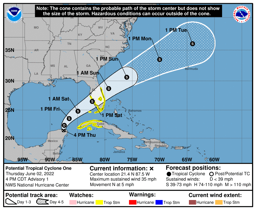
As of 4 pm CDT, the tropical disturbance was centered about 505 miles southwest of Fort Myers, Florida. The system was moving toward the north near 5 mph and this motion is expected to continue through Thursday night. A turn toward the northeast is expected on Friday, and a faster motion toward the northeast is expected Friday night and Saturday. On the forecast track, the system should move across the southeastern Gulf of Mexico through Friday night, and then move across the southern and central portions of the Florida Peninsula on Saturday.
Maximum sustained winds were near 35 mph with higher gusts. The system is expected to become a tropical depression on Friday, and a tropical storm late Friday or Friday night.
NHC forecasters are giving this system a 90 percent chance for tropical development over the next 48 hours.
This potential tropical cyclone poses no threat to the Texas coast.
Bob
Social Media