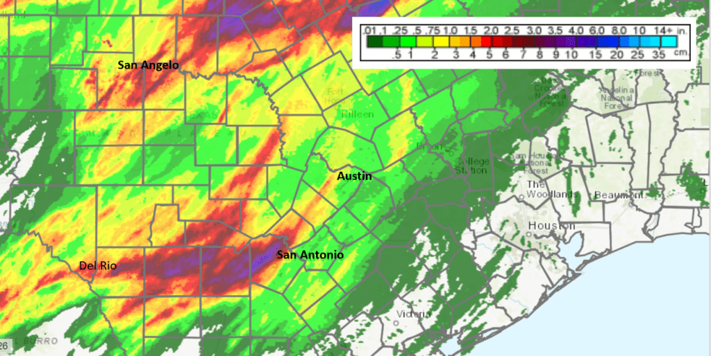
Severe storms erupted over Southwest Texas, parts of the Hill Country and South Central Texas Wednesday evening and Wednesday night. The storms produced a corridor of 1-3 inches of rain from Kerrville, to Fredericksburg to Llano. Totals of 3-4 inches were observed to the north and west of Brownwood. But across the rest of the Hill Country, most totals averaged between a quarter and a half inch. Totals were very low for areas east of Interstate 35.
NWS Estimate of Rain Falling Between 10 am Thursday and 10 am Friday:
The wet and stormy pattern is far from over. A trough of low pressure situated over northern Mexico is forecast to slowly track east and move across Texas Saturday into Saturday night. This system is expected to cause the widespread development of rain showers and scattered thunderstorms across the region on Friday, with the activity continuing Friday night through Saturday night. The rain and thunderstorms should taper off from west to east late Saturday night into Sunday morning.
Forecasts indicate some of the thunderstorms could be strong to severe—mainly for locations located to the east of Interstate 35. Severe weather threats will mainly be large hail and damaging winds.
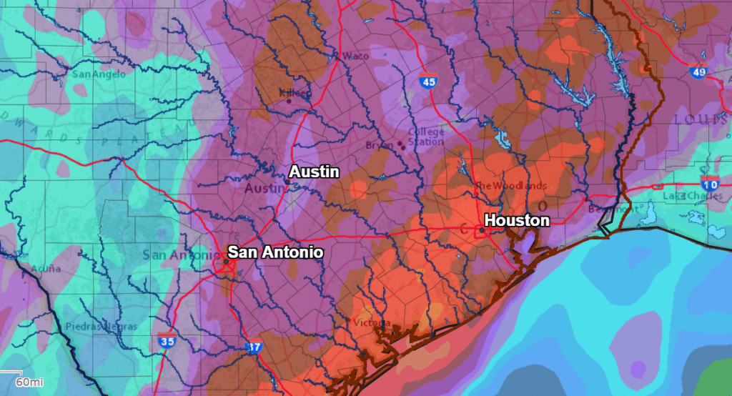
This next round of rain is shaping up to be somewhat wet, with the latest predictions calling for 2-day totals of 1-2 inches across the Hill Country and Central Texas, along with totals of 2-4 inches for areas south of Interstate 10.
NWS Rainfall Forecast for the Period 7 pm Thursday through 7 pm Sunday:
I’ll post a more detailed weather update on Friday.
Bob
Social Media