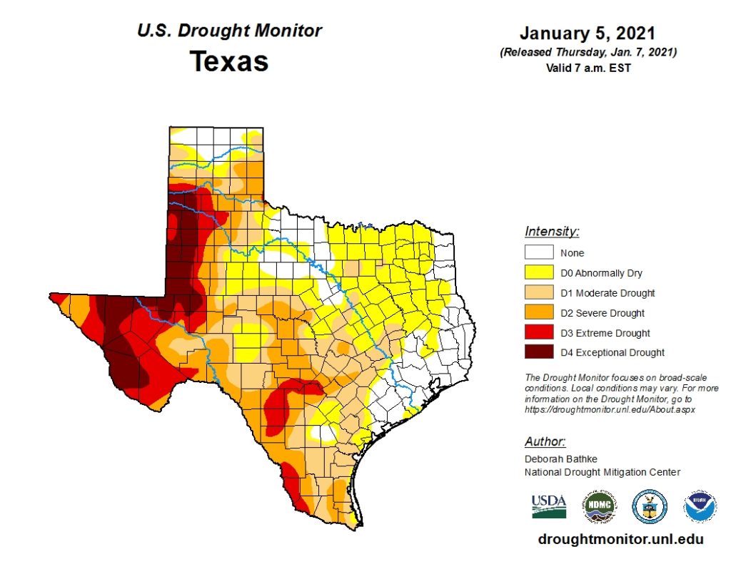
While last week’s rain was the heaviest and most widespread our region has seen in months, it wasn’t quite enough to cause significant drought improvement or drought elimination across the Hill Country or Central Texas regions. Overall, the recent rains appear to have caused about a one category drought improvement.
Thursday’s updated National Drought Monitor showed a large area of severe drought, the second of four possible drought levels, covering the Hill Country between the Brownwood-Coleman area, south to the Kerrville-Boerne area. This area of severe drought then stretched east to Luling, and Smithville. Central Texas and the remainder of the Hill Country were shown to be in moderate drought—the first of four possible levels of drought. Soaking rains last week along with other rains back in December helped cause drought elimination across Southeast Texas, including the middle Texas coast.
Forecasts call for another storm system to move across Central Texas Saturday night through Sunday night and is expected to bring additional rain to our area. National Weather Service forecasts call for totals to generally average around 1 inch.
NWS Rainfall Forecast for the Period 6 pm Thursday through 6 pm Tuesday:
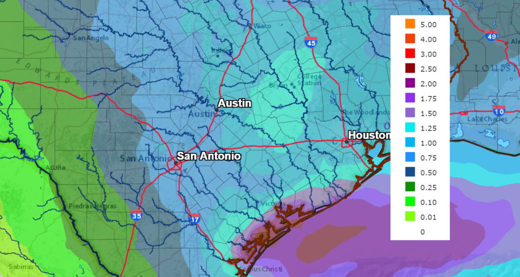
Should these rains materialize, they will likely cause more drought improvement. Let’s keep our fingers crossed.
Bob
Social Media