With little to no rain falling Since October 1, drought conditions have developed and increased in intensity across all of Texas. The generous rains we typically see in October and November just have not happened. Rainfall data indicates the Hill Country and Central Texas regions have seen less than a half inch of rain since October 1st. Totals over this period are running between 4 and 6 inches below normal. Across the coastal Plains region, rainfall since October 1st has toted between 0.5 and 1 inch, which is more than 6 inches below normal. It’s definitely been a dry autumn across Texas.
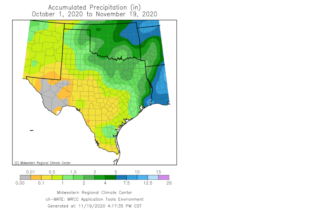
The meager amount of rain falling since October 1 is close to record low levels for much of the region. For example, at Austin-Camp Mabry, rainfall since October 1 has measured just 0.35 inches and this is the second driest such period ever recorded, behind the 0.24 inches set during a similar period in 1924. The 0.35-inch total represents just 6 percent of normal!
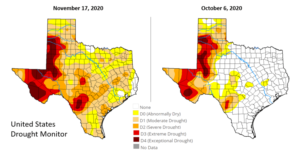
The lack of rain over the past few weeks is reflected well in Thursday’s updated National Drought Monitor. The monitor shows just over seventy five percent of the state is now in some form of drought. Compare this to the drought monitor map of October 6th when only 33 percent of the state was in some level of drought. It’s interesting to note that almost all the Hill Country, Central Texas and the middle Texas coast were free of drought in early October. But today’s depiction shows a widespread mixture of moderate to severe drought, with an area of extreme drought across McCulloch and Mason Counties.
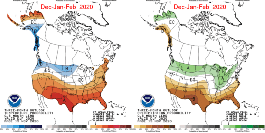
Forecasts are not encouraging for there to be much change in the dry pattern as we move through winter. The Climate Prediction Center’s updated outlook for December-January-February calls for increased odds rainfall will remain below normal across all of Texas. Along with the drier than normal weather, there are increased odds for temperatures to average above normal.
Today’s updated seasonal forecast from the Climate Prediction Center calls for La Niña to peak in intensity over the next few weeks, then slowly weaken January through March. The Pacific is predicted to return to ENSO neutral by April and remain in the neutral territory through summer 2021. Rainfall is forecast to return close to normal levels beginning in April.
Bob
Social Media