Late week forecasts continue to point toward a good chance for rain and strong to severe thunderstorms beginning late Sunday night, continuing through next Tuesday morning. A large trough of low pressure moving southeast out of southern New Mexico is forecast track east-southeast across Central and North Texas Monday into Tuesday. Forecasts call for considerable Gulf moisture to be drawn north into Texas ahead of the approaching trough, causing the atmosphere to become moderately unstable by Monday morning. In addition, considerable atmospheric shear, or a turning of the winds with height, is forecast to develop Monday afternoon into Monday evening. This is expected to cause an increased potential for the development of strong to severe thunderstorms across the Hill Country, Central Texas and coastal region.
An all-hazards severe weather event will be possible with this developing storm system Monday afternoon through Monday night. It will include very large hail, damaging winds and tornadoes. A broad line of rain and thunderstorms is predicted to develop along and just behind a Pacific cold front when it tracks east across the region Monday night. The storms are forecast to push east of our region after sunrise next Tuesday morning.
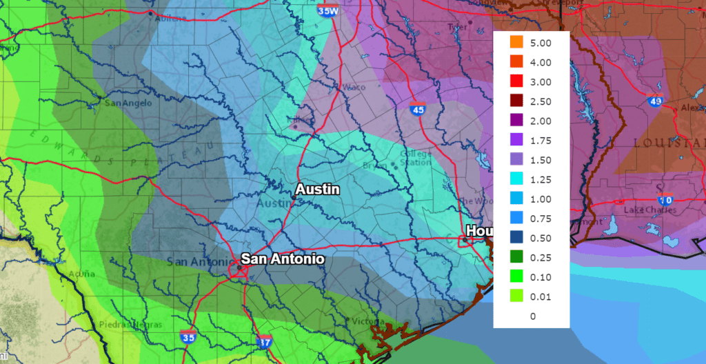
Rainfall forecasts have trended a touch higher, compared to forecasts from earlier in the week. Thursday’s data is calling storm totals up to a half inch across the western Hill Country, and to around 1 across the eastern Hill Country. Totals across Central Texas and the middle Texas coast are predicted to be in the range of 1-1.5 inches.
NWS Rainfall Forecast for the Period 7 pm Thursday through 7 pm Tuesday:
Dry and sunny weather looks to follow this storm system beginning next Tuesday afternoon.
Bob
Social Media