The August heat wave continued in full force over the weekend, with most locations recording temperatures at or several degrees above 100 degrees. In fact, record high temperatures were tied or broken at several locations. But a small break in the persistent dry and hot pattern developed Sunday evening when a large complex of rain and thunderstorms developed over North Texas, with the storm complex moving to the south-southeast. The showers and thunderstorms reached the very northern part of our basin, between Abilene and Brownwood shortly after midnight, producing totals of 0.5-1 inch. Unfortunately, the area of rain weakened and diminished when into moved into the Hill Country and Central Texas regions after 3 am. A few lucky spots saw totals to around a quarter inch, while most areas stayed dry. It was the same story across the across the middle Texas coast where no rain was recorded.
The sprawling ridge of high pressure which had been centered over Texas last week shifted to the western U.S. over the weekend and is now centered over western Utah. To the east of the ridge, a broad trough of low pressure in the upper atmosphere stretches from eastern Canada to Mid-Atlantic states. Sunday night’s rain and storms over North Texas developed when a weak trough of low pressure rotated around the western ridge and tracked south into Texas. Unfortunately, the atmosphere over the southern half of Texas was just too stable to support much rain and thunderstorm development.
There will be a 20-30 percent chance for a few scattered rain showers and isolated thunderstorms across the region this afternoon and evening due to left over boundaries produced by last night’s last storm complex. The most favorable area for rain and storms appears to be over the area between La Grange, San Antonio and Del Rio. Overall, the atmosphere across Central Texas remains fairly stable, so a widespread coverage of rain is certainly not expected. For locations that do happen to see a shower, totals are predicted to only average around a quarter inch.
The temperature is forecast be a little less hot this afternoon due to more scattered clouds and slightly cooler temperatures located a few thousand feet above the surface. This afternoon’s temperature is forecast to generally reach near 97-101 degrees across the Hill Country and Central Texas regions and the upper 90s across the coastal plains region. Expect a light north to northeast breeze at 5-10 mph. Dry and quiet weather is forecast Monday night.
Mostly sunny and hot weather is expected across the region Tuesday. A couple of isolated rain showers or thunderstorms will be possible across the Hill Country and Central Texas regions Tuesday afternoon, but the probability for rain will be less than 20 percent. High temperatures will generally be near 98-101 degrees.
A stagnant, hot and dry pattern is forecast across our region Wednesday through Sunday. Although the center of the high pressure ridge is forecast to remain over the Great Basin through the period, there will still be enough influence from the ridge to cause our weather to remain hot and dry. Temperatures look to stay quite hot, but they should be lower than the extremely hot readings we saw over the weekend. High temperatures Wednesday through Sunday are predicted to be near 98-102 degrees across the Hill Country and Central Texas regions and in the mid to upper 90s across the coastal plains region. A few isolated Sea Breeze showers will be possible across the coastal plains region Friday through Sunday.
The outlook for next week calls for only minor changes in the hot and dry pattern. The center of the high pressure ridge is forecast to shift southeast to southern Colorado and northern New Mexico. However, the overall ridge is forecast to weaken some as the jet stream strengthens over the US/Canadian border.
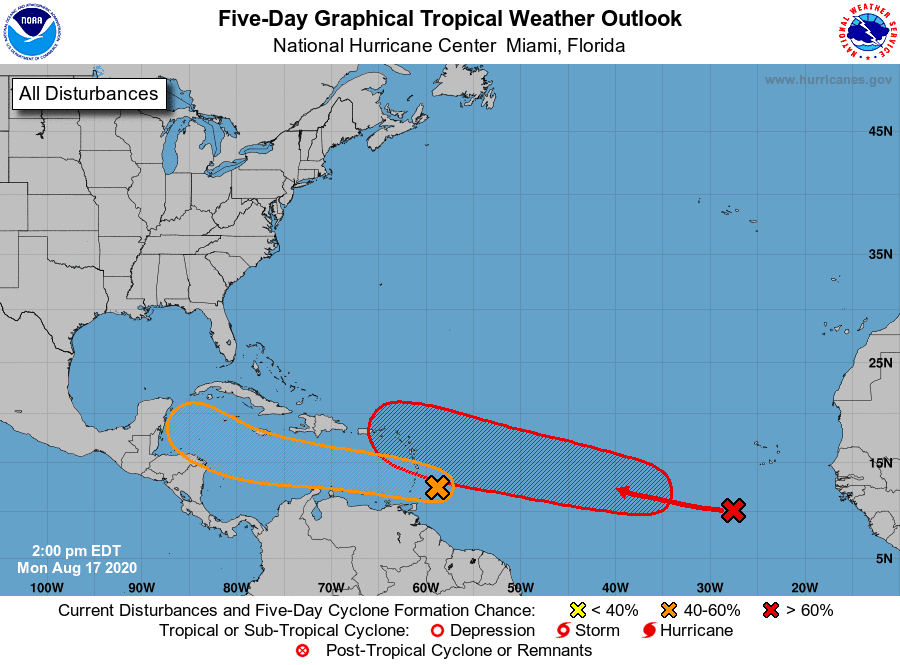
We will need to keep an eye on possible tropical weather in the southern the Gulf of Mexico next week. Forecast solutions call for an area of disturbed weather to develop over the western Caribbean Sea late this week, with the area of clouds and moisture spreading over the Yucatan Peninsula this weekend. Whatever is left of this system is forecast to spread into the south central Gulf of Mexico early next week. This area of clouds and showers may drift northwestward towards the Texas coast by the middle of next week.
The National Hurricane Center is monitoring two strong tropical waves located in the central and eastern tropical Atlantic. Either of these two systems could possibly move toward the Gulf of Mexico in another 5-10 days. See the tropical weather outlook section below for more details.
Tropical Weather Outlook
Weather conditions across the tropical Atlantic, the Caribbean Sea and the Gulf of Mexico are currently quiet. Tropical Storm Kyle lost its tropical characteristics early Saturday over the North Atlantic. Tropical Storm Josephine degenerated into a trough of low pressure north of the Leeward Islands late Sunday.
National Hurricane Center forecaster are currently keeping a close watch on two strong tropical waves. Both systems show a good potential for tropical development.
The first tropical wave is currently located just east of the Windward Islands and is producing a large area of disorganized shower and thunderstorm activity. The disturbance is expected to move westward at about 20 mph during the next few days, and that fast forward speed is likely to limit significant development while the system approaches the Windward and southern Leeward Islands today, moving across the eastern and central Caribbean Sea on Tuesday and Wednesday. After that time, however, the system is expected to move more slowly westward across the western Caribbean Sea, where upper-level winds could become more conducive for the development of a tropical depression during the latter part of this week. Regardless of development, locally heavy rainfall and gusty winds are expected over portions of the Windward and southern Leeward Islands beginning today through Tuesday morning.
NHC forecasters are giving this system a 50 percent chance for tropical development over the next 5 days.
The second tropical wave is located over the eastern tropical Atlantic. It is forecast to interact with another disturbance located several hundred miles southwest of the Cabo Verde Islands within the next day or two. This interaction is expected to lead to the formation of a broad area of low pressure, and conditions are forecast to be conducive for the development of a tropical depression during the middle-to-latter part of this week while the system moves westward to west-northwestward at 15 to 20 mph across the central and western portions of the tropical Atlantic.
NHC forecasters are giving this system a 70 percent chance for tropical development over the next 5 days.
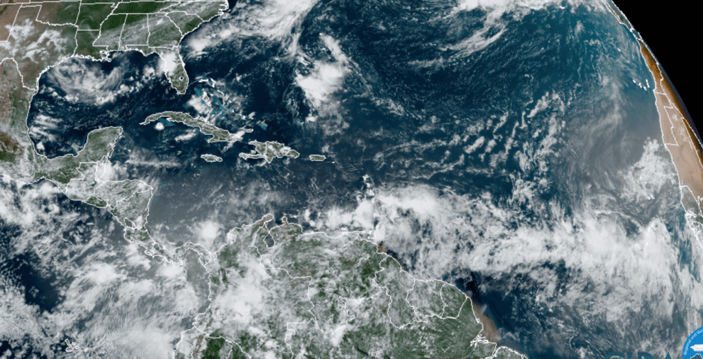
RAMMB-CIRA 08/17/2020 12:50 pm CDT
An Unusually Hot August So Far
Weather during the month of August is almost always very hot and miserable, but data through the middle of the month indicates this August ranks among some of the very hottest on record. Through August 16th, the average temperature at Austin-Camp Mabry has been 90.3 degrees, which is 4.3 degrees above normal. Month to date, August 2020 is tied with August 2019 for the second hottest August on record. The hottest August on record is, you guessed it, 2011 where the average temperature through the 16th was 1.5 degree warmer than the current average.
Month to date, the average high temperature has been 103.6 degrees and the average low temperature has been 77.1 degrees. Just a trace of rain has been recorded.
Think Cooler: The month of October is only 6 weeks away.
Bob
Social Media