The drier than normal influence from La Niña is forecast to weaken and possibly fade as we move through spring. That’s the January updated weather outlook released Thursday from the National Weather Service’s Climate Prediction Center (CPC). CPC’s updated outlook calls for the current moderate-intensity La Niña to weaken February through March, with the Pacific returning to ENSO-neutral sometime in April or May. ENSO-neutral conditions are predicted to continue through the upcoming summer fall.
CPC’s updated rainfall outlook calls for increased odds rainfall will remain below normal across Texas during the month of February and in the 3-month periods of February/March/April and March/April/May. However, beginning with the period of April/May/June and continuing through summer and fall, the outlook changes to “Equal Chances for Above, Below or Near Normal Rainfall”. In other words, the pattern of below normal rainfall will fade in the spring, with no clear rainfall trend currently identified for late spring and summer.
CPC Rainfall Outlook
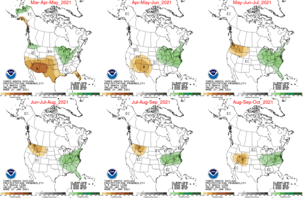
From a Central Texas rainfall perspective, this new outlook give us a glimmer of good news. The months of May and June are typically the wettest two months of the year and it is possible rainfall could trend toward normal or even above normal during these two traditionally wet months.
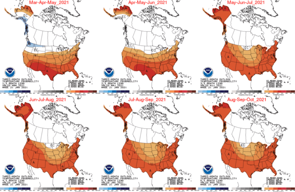
CPC’s updated temperature outlook calls for increased odds temperatures will average above normal in February and continue above normal this spring and summer.
CPC Temperature Outlook
A good portion of the spring outlook involves how fast La Niña will fade and lose its influence on our region’s weather. Let’s hope the forecast for steady weakening over the next couple of months holds true.
Bob
Social Media