Today, June 1st, marks the official start to the 2022 Atlantic Hurricane Season. Most forecasters are anticipating this season to be a busy one, with an above-normal number of storms. Several climate factors, including a persistent La Niña that is likely to persist throughout the hurricane season, warmer-than-average sea surface temperatures in the Atlantic Ocean and Caribbean Sea, weaker tropical Atlantic trade winds and an enhanced west African monsoon are all behind the forecast for increased activity. An enhanced west African monsoon supports stronger African Easterly Waves, which seed many of the strongest and longest lived hurricanes during most seasons.
On this first day of hurricane season, National Hurricane Center forecasters are closely monitoring two areas of disturbed weather.
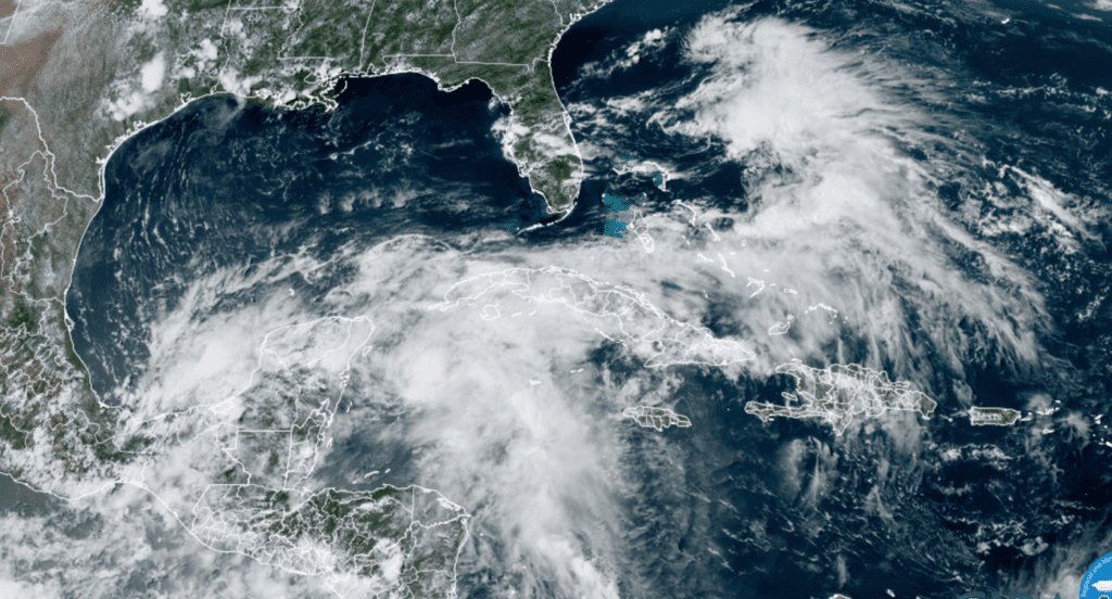
The first area of interest is near the Yucatan Peninsula and the southeastern Gulf of Mexico. Here, a broad area of low pressure is located near the east coast of the Yucatan Peninsula and is producing a large area of disorganized showers and thunderstorms over the northwestern Caribbean Sea, and Yucatan Peninsula.
NOAA/Colorado State University/RAMMB 06/01/2022 2:40 pm
Despite strong upper-level winds, gradual development is forecast and this system is likely to become a tropical depression while it moves slowly northeastward over the northwestern Caribbean Sea and southeastern Gulf of Mexico during the next day or two. Regardless of development, locally heavy rainfall is likely across portions of the Yucatan Peninsula during the next day or so, spreading across western Cuba, South Florida, and the Florida Keys on Friday and Saturday. Interests in the Yucatan Peninsula, western Cuba, the Florida Keys, and the Florida Peninsula should monitor the progress of this system. This system is not expected have any impact on the Texas coast.
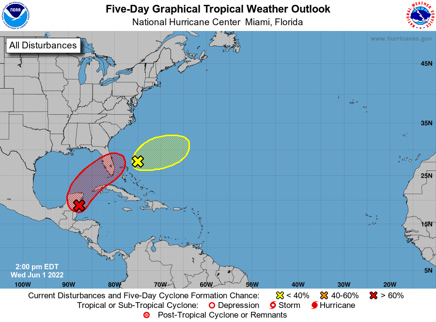
The second area of interest is located over the southwestern Atlantic, northeast of the Bahamas. A weak surface trough located about 150 miles northeast of the northwest Bahamas is producing disorganized shower activity. Surface pressures are currently high across the area, and significant development of this system appears unlikely as it moves generally east-northeastward over the next several days away from the southeastern United States.
NHC forecasters are giving this system a low chance, just a 10 percent chance for tropical development over the next 5 days.
The season is very young and tropical cyclone activity typically is fairly low through June and July and then increases during August. But if today’s disturbed weather is any indication, we could see increased activity early in the season.
Bob
Social Media