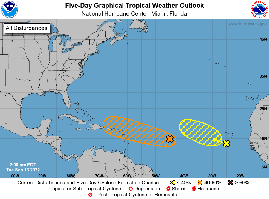
National Hurricane Center forecasters are beginning to keep a close watch on a tropical wave flaring up over the central tropical Atlantic. The tropical wave was located Tuesday afternoon about 1000 miles east of the Lesser Antilles. Afternoon satellite images showed numerous showers and thunderstorms over the area, but no real organization so far. According to the Hurricane Center, environmental conditions will be marginally conducive for tropical development over the next few days and a tropical depression could form. The system is moving to the west-northwest and is predicted to reach the Leeward Islands on Friday. NHC forecasters are giving this system a medium chance, a 40 percent chance, for tropical development over the next 5 days.
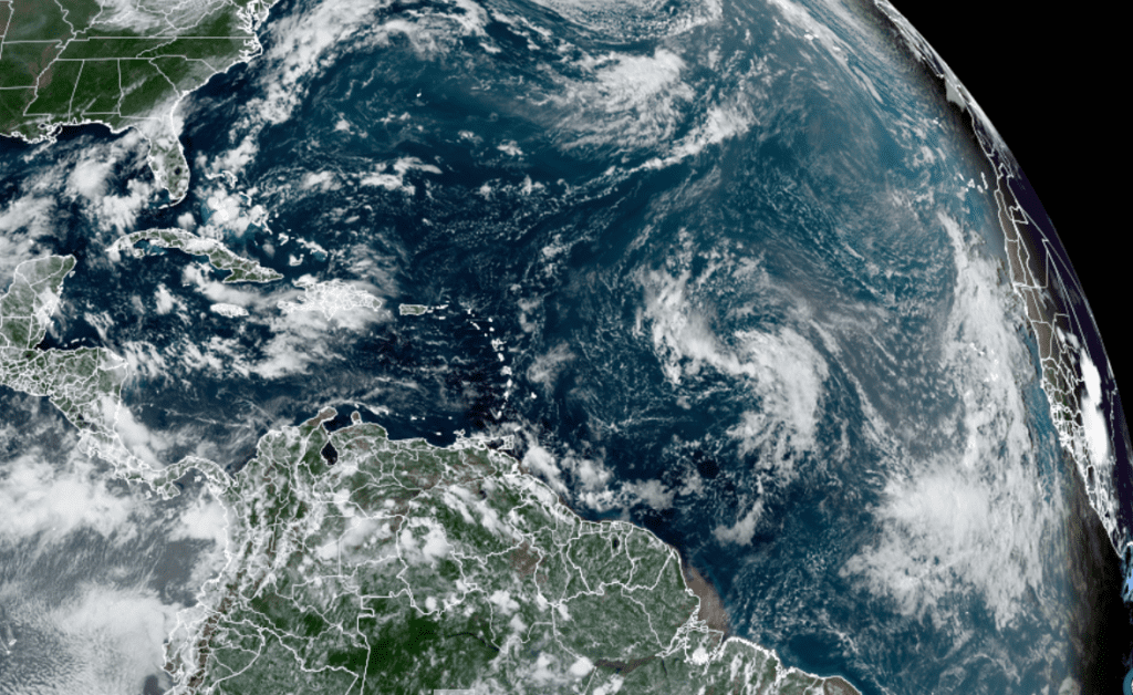
Forecasters are also monitoring an area of showers and thunderstorms associated with a tropical wave that is passing near the Cabo Verde Islands. The thunderstorm activity associated with the system became more limited in coverage today, compared to Monday. According to the Hurricane Center, environmental conditions are forecast to remain only marginally favorable for tropical development over the next several days, and the chance for tropical development appears to be decreasing. The system is forecast to move westward to west-northwestward across the eastern and central tropical Atlantic through the end of the week. NHC forecasters are giving the wave a low chance, just a 10 percent chance, for tropical development over the next 5 days.
Bob
Social Media