Quiet and unseasonably mild weather conditions continue across Central and South Texas as we close out the work week. The storm track remains well up to the north and west, leaving few opportunities for rain to develop across our region. This morning, a weak cold front sagged south out of North Texas but it has pulled up stationary from north of Austin to Junction to near Fort Stockton. Although considerable low-level Gulf moisture has spread inland ahead of and behind the cold front, atmospheric conditions look to be too stable for rain to develop. Widespread morning clouds are forecast to slowly decrease through the afternoon hours, allowing the sky to become partly cloudy. High temperatures will be in the mid-70s across the Hill Country and near 80-82 degrees at most other locations.
Today’s weak cold front is forecast to lift back to the north this evening and overnight, allowing a large area of low clouds to spread north from the Gulf all the way into the Hill Country. Patchy fog and some spotty drizzle will be possible across parts of the region Saturday morning. This will be followed by a partly cloudy sky and warm temperatures Saturday afternoon. High temperatures will be mostly in the low and mid-80s. Expect southerly breezes at 10-15 mph along with occasional gusts to 25 mph.
A trough of low pressure crossing the northern Plains state on Saturday will help push a fairly strong cold front across Texas Saturday night into Sunday morning. The front is expected to reach the northern Hill Country around midnight Saturday night and the Austin area before sunrise on Sunday. The front will continue moving southeast and should push off the middle Texas coast by midday Sunday. Once again, no rain is forecast with the front when it crosses the Hill Country and Central Texas regions. However, there will be a slight chance for a few showers and isolated thunderstorms across the coastal plains regions. Rain amounts, if any, should average around a tenth of an inch. Sunny, breezy and slightly cooler weather will follow the cold front on Sunday. Expect northeasterly winds at 10-20 mph along with gusts to 30 mph. The strong winds should decrease some Sunday night. High temperatures across the Hill Country and Central Texas regions will be in the low and mid-70s. A high near 80 is forecast for the coastal plains regions. Lows Monday morning will include the low 40s across the Hill Country, the mid and upper 40s across Central Texas and the low to mid-50s towards the coast.
The outlook for next week calls for a sunny and dry pattern as a bubble of Canadian high pressure settles over Texas for the first half of the week. The high is predicted to move off to the east the second half of the week. High temperatures Monday through Wednesday will generally be in the mid and upper 70s, warming to the upper 70s to 80 degrees Thursday and Friday. Lows Tuesday and Wednesday mornings across the Hill Country and Central Texas regions will be in the 40s, warming into the 50s Thursday and Friday mornings. Across the coastal plains regions, lows throughout the week will be in the 50s.
The outlook for next weekend calls for more sunny and warm weather with high temperatures in the lower 80s.
Forecasts call for another fairly strong cold front to sweep south across the area next Sunday night. Dry and cooler weather looks to follow the cold front through the first half of the week of November 23rd, with highs in the upper 60s to low 70s. Lows will be in the 40s. The outlook for the period around Thanksgiving is highly uncertain at this point. There are some hints at a chance for rain during this period as a trough of low pressure moves in from the west. But details are very uncertain. Temperatures are forecast to be mild as the coldest air remains well up to the north. Stay tuned for additional updates regarding Thanksgiving.
Tropical Weather Outlook
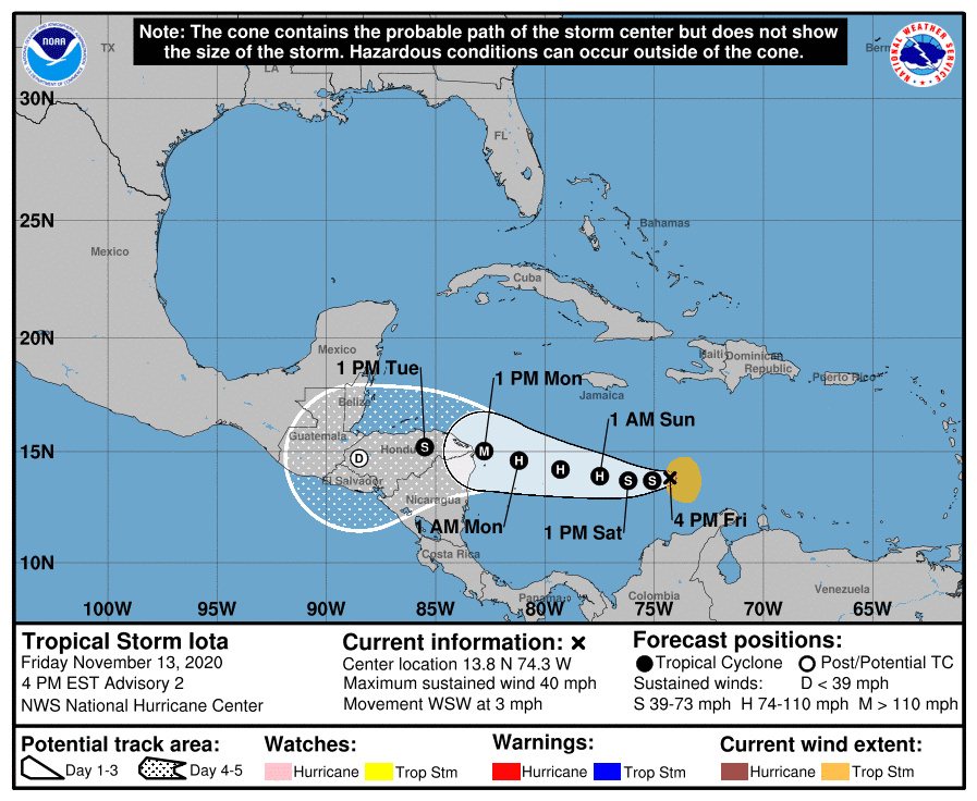
…An Area of Disturbed Weather Over the Caribbean Sea has Strengthened to become Tropical Storm Iota…
As of 3 pm CST, the center of Tropical Storm Iota was located about 335 miles south-southeast of Kingston, Jamaica. Iota was moving toward the west-southwest near 3 mph, and this motion is expected to continue through early Saturday. A westward to west-northwestward motion at a slightly faster forward speed is expected to begin by late Saturday and continue through Monday. On the forecast track, Iota will move across the central Caribbean Sea during the next day or so, and approach the coasts of Nicaragua and northeastern Honduras late Sunday and Monday.
Maximum sustained winds have increased to near 40 mph with higher gusts. Steady to rapid strengthening is likely over the weekend, and the system is forecast to be a major hurricane when it approaches Central America early next week.
Iota becomes the 30th named storm of the recording-breaking 2020 hurricane season.
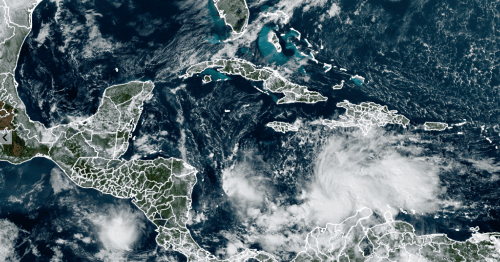
RAMMB-CIRA-Colorado State University 11/13/2020 1:10 PM CST
Elsewhere, Tropical Storm Eta moved across northern Florida Thursday and has pushed into the waters off the coast of the Carolinas. Eta lost its tropical characteristics and is now classified as an extratropical low pressure system. The remnants of Eta are forecast to pull away from the East Coast this afternoon and track across the open waters of the Atlantic, to the north of Bermuda this weekend.
The Leonid Meteor Shower this Weekend and Early Next Week
From midnight to dawn this weekend – beginning on the mornings of November 14 or 15, 2020 – watch for meteors in the annual Leonid meteor shower. The new moon on November 15 guarantees dark skies in rural locations on the shower’s peak mornings. The meteors are expected to fall most abundantly in the dark hours before dawn on Tuesday, November 17. The usual rules for meteor-watching apply: go to a dark country location in the hours before sunrise. Bring along a lawn chair or blanket for stretching out and gazing upward over a period of at least an hour. The Leonids are a modest, though reliable, shower. In a dark, moonless sky, you might see up to 10 to 15 meteors per hour. The absence of moonlight will undoubtedly enhance the view of the shower this year.
Have a good weekend.
Bob
Social Media