Thursday morning satellite images showed the circulation associated with the persistent area of low pressure over west-central Caribbean Sea has become better defined and better organized. Based on satellite and surface data, the system has been upgraded to a tropical depression. Forecasts call for the system to primarily be a threat to the area between the far upper Texas coast and the southern coast of Mississippi.
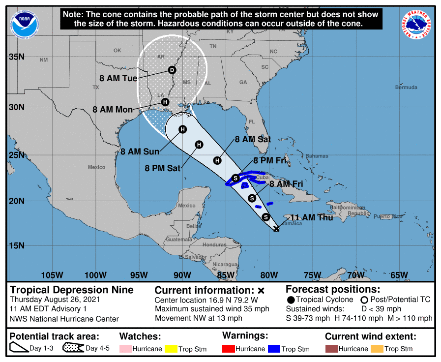
At 10 am CDT, the depression was located over the west-central Caribbean Sea, roughly 115 miles south-southwest of Negril, Jamaica. The depression was moving toward the northwest near 13 mph, and this general motion should continue over the next few days. On the forecast track, the center of the depression is forecast to pass near of over the Cayman Islands tonight, the Isle of Youth and Western Cuba Friday, and move over the southeastern and central Gulf of Mexico Friday night and Saturday. The system is forecast to approach the U.S. northern Gulf coast on Sunday.
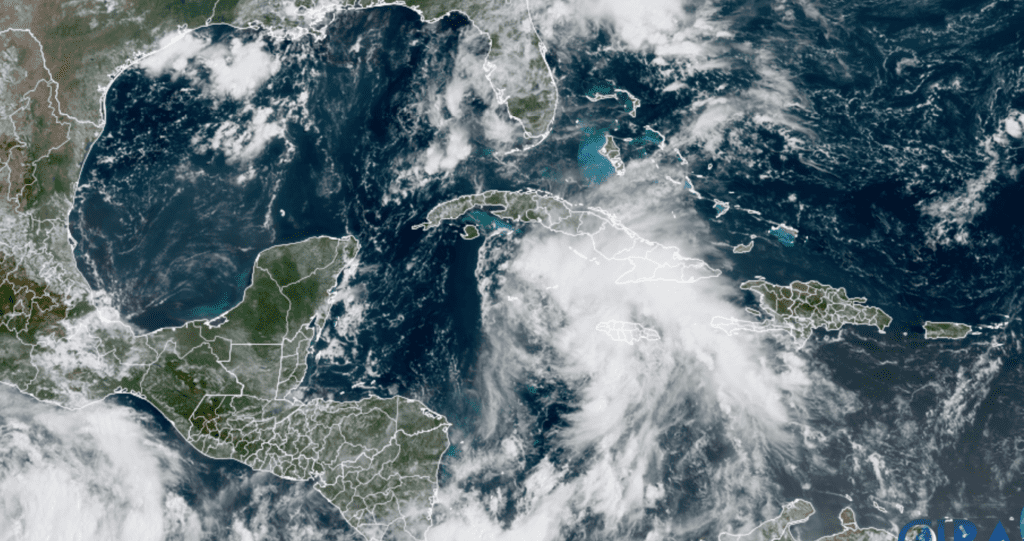
NOAA/Colorado State University/RAMMB 08/26/21 11:00 am CDT
Maximum sustained winds are near 35 mph with higher gusts. Steady strengthening is forecast during the next few days. The depression is expected to become a tropical storm tonight, and become a hurricane when it is near western Cuba or over the southeastern Gulf of Mexico Friday. Additional strengthening is likely over the Gulf of Mexico and the system could be near major hurricane strength when it approaches the northern Gulf coast Sunday night or Monday.
Forecast model guidance has come into much better agreement on the ultimate track of Tropical Depression Nine now that a low center has formed. The system is expected to be steered around the western side of a high pressure ridge located over the southeastern U.S. for the next few days. The National Hurricane’s forecast cone of uncertainly at landfall stretches from just east of Galveston Bay, to the southern coast of Mississippi.
Based on the latest forecast track, impacts from this tropical system should be minimal across Central Texas and the middle Texas coast as our region will be on the dry, western side of the storm. The main impacts look to be coastal related, with increasing swells and minor coastal flooding at high tide late expected across the middle Texas coast this weekend into early next week.
Bob
Social Media