Visible satellite imagery has shown that the area of low pressure being monitoring over the tropical Atlantic has developed a less-elongated circulation with a well-defined center. For the most part, deep convection has persisted with the system since about this time yesterday, save a brief period of warming cloud tops this morning. According to the National Hurricane Center (NHC), the low now meets the criteria of a tropical cyclone, and the NHC is now issuing advisories on Tropical Depression Eleven.
As of 5:00 pm CDT, the e center of Tropical Depression Eleven was located about 1450 miles east of the Lesser Antilles. The depression is moving toward the west near 16 mph and this general motion is expected to continue through Wednesday. A west-northwestward motion at a similar forward speed is forecast to begin Wednesday night and continue through the rest of the week.
Maximum sustained winds are near 35 mph with higher gusts. Some strengthening is forecast during the next 48 hours, and the depression is expected to become a tropical storm by Wednesday night.
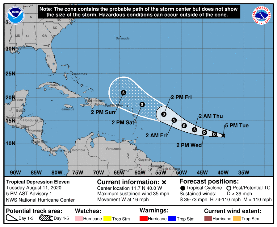
NHC forecasters point out that by Sunday and Monday, westerly or southwesterly wind shear is forecast to develop and increase to around 20-30 knots, which is likely to induce significant weakening. Conditions may become hostile enough such that the global models are showing the system opening up into a trough near the northern Leeward Islands by Sunday, which is a plausible scenario.
Bob
Social Media