Tropical Depression Eta continues to produce heavy rains and life-threatening flooding over portions of Central America. According to the National Hurricane Center Thursday afternoon, the center of the diffuse circulation of Tropical Depression Eta was located over northwestern Honduras. Top sustained winds were down to 35 mph, and the center of Eta was mostly absent of any strong showers and thunderstorms. Eta’s heaviest rains had exited Honduras and were spreading into eastern Guatemala and Belize.
A Thursday afternoon visible satellite image showed a large cluster of clouds and intense storms located offshore, in the Northwest Caribbean. This is where Eta is expected to move to Friday on a potential path that will take it across Cuba this weekend and near southern Florida early next week.
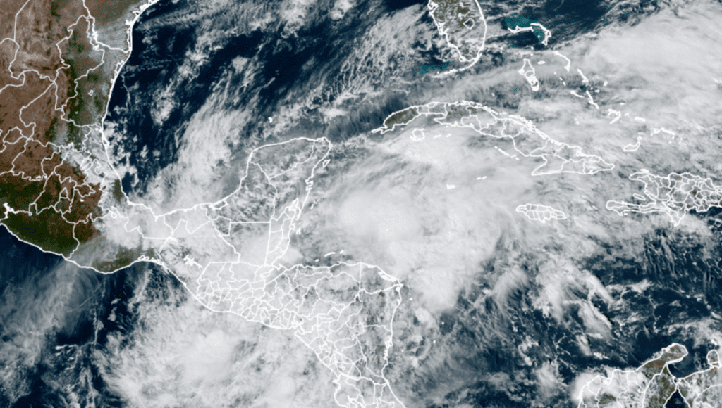
RAMMB-CIRA/Colorado State University 11/05/2020 1:00 pm CST
The circulation of Eta is forecast to move offshore Thursday night, drift to the north and then to the northeast. An upper-level trough moving across the eastern Gulf of Mexico is expected to pull Eta northeastward at a faster pace Friday and Saturday. Most of the forecast models agree Eta will reconsolidate and re-intensify around a more well-defined center as it heads toward Cuba. Waters in the Caribbean Sea are still plenty warm and will be supportive of strengthening. However, drier air is forecast to get pulled into the system by the weekend, which may favor weakening.
Overall, conditions do not favor anything close to those which caused Eta’s phenomenal intensification to Category 4 strength earlier this week. The National Hurricane Center is forecasting the remnants of Eta to strengthen into a tropical storm Friday and remain at that intensity through the weekend.
The forecast for Eta gets more complicated beyond this weekend when an upper-trough is forecast to dive into the eastern Gulf and possibly getting pulled toward the trough or possibly rotating around it. The National Hurricane Center’s 5-day forecast track calls for Eta to track northwest from Cuba, reaching the eastern Gulf of Mexico about Tuesday. It’s possible Eta could brush southern/southwestern Florida and the Florida Keys late Sunday into Monday.
Despite the forecast for Eta to reach the eastern Gulf of Mexico early next week, there is little to no chance for the system to track west towards the Texas coast.
Bob
Social Media