Tropical Storm Cristina formed late Monday in the Eastern tropical Pacific Ocean and it appears it is on its way to becoming the first hurricane of the 2020 season in either the eastern Pacific or Atlantic Oceans.
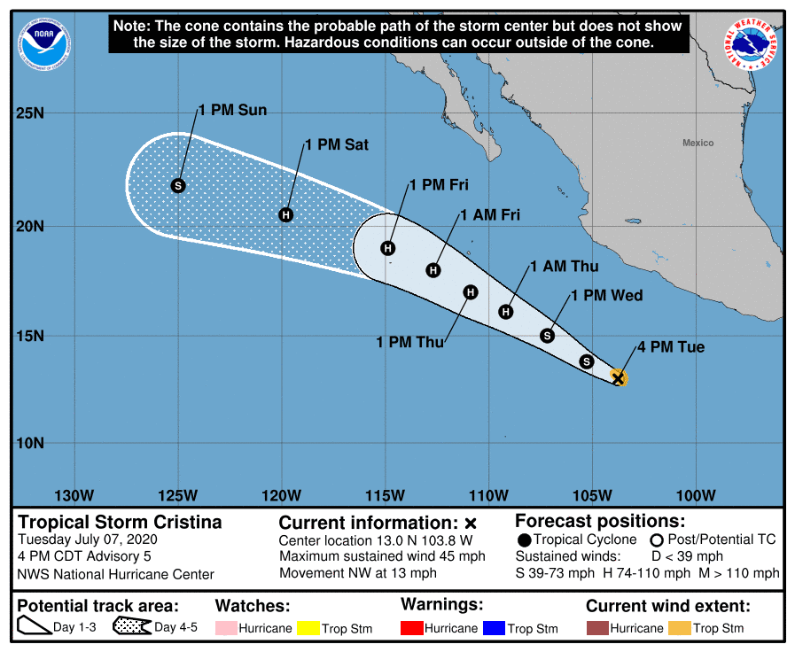
As of Tuesday afternoon, the tropical storm was located in open waters, about 415 miles south of Manzanillo, Mexico. Cristina is moving toward the northwest near 13 mph, and this general motion is expected to continue for the next few days, keeping the cyclone well away from the coast of Mexico.
Satellite wind data indicate that the maximum sustained winds are near 45 mph with higher gusts. Atmospheric and oceanic conditions are favorable for additional strengthening and Cristina is forecast to become a hurricane in a day or two.
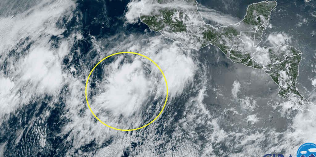
RAMMB-CIRA 07/07/20 12:50 pm CDT
National Hurricane Center forecasters call for Christina to become a hurricane Wednesday and remain at hurricane intensity through Saturday as it tracks northwest, away from land.
Season to date, there have been three tropical storms and one tropical depression in the Eastern Pacific so far this year. Meanwhile the Atlantic basin has had five tropical storms. Tropical Storm Edouard on Monday was the earliest fifth Atlantic named storm, beating the record set by Emily on July 12, 2005. The fifth named storm of the year typically does not occur until August 31, so this is nearly two months ahead of climatology. Also according to climatology, the first hurricane of the season usually arrives by August 10.
National Hurricane Center forecasters are currently monitoring an area of low pressure located inland along the Georgia-South Carolina border southeast of Augusta, Georgia. This system continues to produce a large area of showers and heavy rain over portions of the southeastern United States. The low is expected to move slowly eastward overnight before turning east-northeastward on Wednesday. By Wednesday night and Thursday, the system is forecast to move generally northeastward near or just offshore the coast of the Carolinas and the mid-Atlantic states, and a tropical or subtropical cyclone could form later this week if the low moves over the warm waters of the western Atlantic.
The NHC is giving this system a 50 percent chance for tropical development over the next 5 days.
Bob
Social Media