A Tropical Storm Warning is in effect for the coast of Texas, from the Mouth of the Rio Grande to Port Aransas.
A Tropical Storm Watch is in effect for the coast of Texas from north of Port Aransas to High Island.
A Storm Surge Watch is in effect for the coast of Texas from the Mouth of the Rio Grande to High Island.
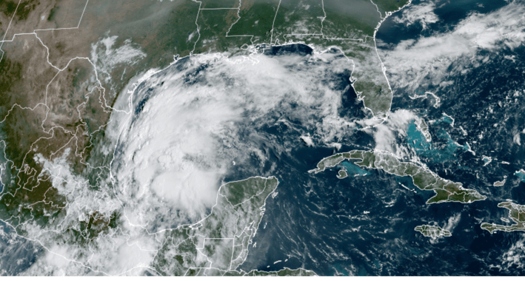
The showers and thunderstorms which have persisted over the southern Bay of Campeche the past couple of days increased overnight and become better organized. An Air Force Reserve reconnaissance plane investigating the system Sunday morning found a closed off a low level circulation along with an area of 40-50mph winds to the north and northeast of the circulation. Based on these factors, the system was upgraded to Tropical Storm Nicholas, the fourteenth named storm of the season.
Nicholas is currently located in an environment that is somewhat favorable for gradual strengthening until the system reaches the Texas coast sometime late Monday into Tuesday. The latest National Hurricane Center forecast calls for Nicholas to be a high-end tropical storm when it makes landfall.
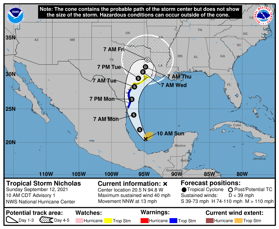
Nicholas is forecast to move to the west-northwest this afternoon and tonight, turning to the north and moving along the eastern coast of Mexico and Deep South Monday into Monday night. The tropical storm is forecast to turn to the north-northeast Monday night and make landfall somewhere just south of, or near Matagorda Bay early Tuesday morning. Nicholas is forecast to continue on a general northeastward track toward Houston Tuesday night into Wednesday.
Current Position
As of 10 am CDT Sunday, the center of Tropical Storm Nicholas was located by reconnaissance aircraft over the southern Bay of Campeche, roughly 130 miles northeast of Veracruz Mexico, or 405 miles southeast of the Mouth of the Rio Grande River. Nicholas was moving toward the north-northwest
near 13 mph, and this general motion is expected to continue through tonight. A slower northward or north-northeastward motion is forecast by late Monday or Monday night. On the forecast track, the center of Nicholas will pass near or just offshore the coasts of northeastern Mexico and South Texas late Monday, and approach the south or central Texas coast Monday night or early Tuesday. Data from an Air Force Reserve reconnaissance aircraft indicate the maximum sustained winds were near 40 mph with higher gusts. Gradual strengthening is forecast while Nicholas approaches the northwestern Gulf coast during the next day or so.
Impacts
Rainfall
Bands of moderate to heavy rain are forecast to begin spreading inland across the lower and middle Texas coast this afternoon (unrelated to the tropical storm). Additional bands of moderate to heavy rain are forecast to spread across the middle Texas coast (mainly the coastal counties, including Wharton and Matagorda counties tonight and Monday. The current setup tends to favor the coastal areas for the greatest rainfall amounts, with a sharp gradient extending inland to the northwest. Heavy rains are forecast to continue across the middle Texas coast Tuesday through Wednesday, with moderate rains forecast Thursday into Friday.
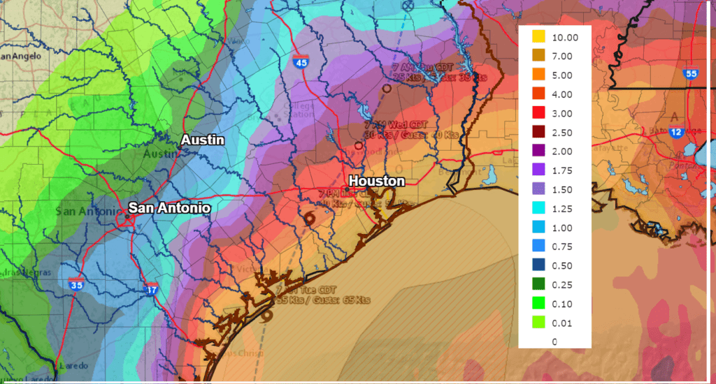
For the period today through Friday, areas near the coast (Matagorda County) are forecast to receive between 5 and 8 inches, with isolated totals of 10-15 inches possible. For areas south of I-10, totals of 3-6 inches are forecast, with isolated totals of 8-12 inches possible. For the area between La Grange and Columbus, totals of 2-4 inches are forecast.
For the Austin/Interstate 35 corridor, the eastern Hill Country and much of Central Texas, scattered showers and thunderstorms are forecast to increase in areal coverage Monday, with scattered showers and thunderstorms continuing Tuesday through Thursday. Rain amounts through Friday will range from a quarter to a half inch across the eastern Hill Country , to around 1-1.5 inches between Bastrop and La Grange.
NWS Rainfall Forecast for the Period 7 am Sunday through 7 am Next Sunday:
Wind
Winds are forecast to increase to 55-60mph across Matagorda County late Monday night into Tuesday morning as the center of Nicholas moves inland. Lower wind speeds are forecast between Columbus and Wharton.
Tides
Storm surge/tide values of 2-4 ft above normal dry ground will be possible are forecast along most of the Texas coast, including the middle coast, Tuesday into Wednesday. Minor coastal flooding is expected around high tide on both Monday and Tuesday.
NOAA/Colorado State University/RAMMB 09/12/21 10:30 am CDT
Bob
Social Media