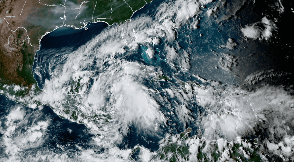
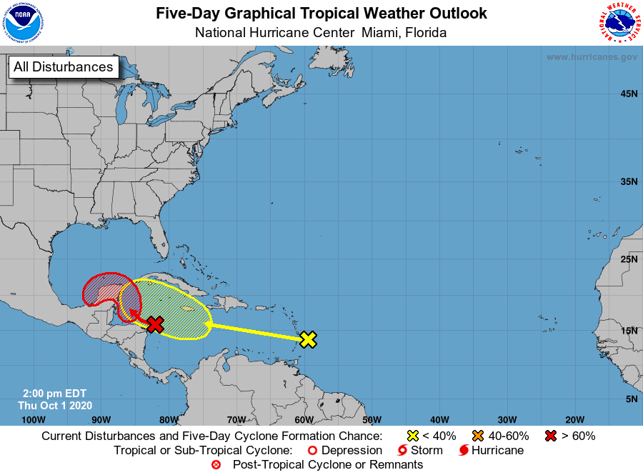
National Hurricane Center forecasters are closely monitoring a well-defined tropical wave over the west-central Caribbean Sea. This system is producing a large area of clouds and disorganized showers and thunderstorms. Environmental conditions are expected to be conducive for a tropical depression to form by early next week, but only if the system moves and remains over the waters of the northwestern Caribbean Sea or the southern Gulf of Mexico. Development will become less likely if the system moves over the Yucatan Peninsula or northern Central America. Regardless of development, this system is expected to produce locally heavy rains, with possible flash flooding, over portions of southeastern Mexico, Central America, and western Cuba during the next several days. National Hurricane Center forecasters are giving this system a 70 percent chance for development over the next 5 days.
NOAA-RAMMB/CIRA10/01/2020 4:00 pm CDT
A large ridge of high pressure is forecast to steer this disturbances to the west-northwest through Sunday. On this track the system is forecast to reach the coast of Mexico’s Yucatan Peninsula on Saturday, or possibly slide just north of Cancun and pass through the Yucatan Channel between Cuba and Mexico. As of now, it appears unlikely the disturbance will be a threat to the Texas or U.S. Gulf Coast next week.
The National Hurricane Center is also monitoring another tropical wave located just east of the Lesser Antilles. This system is also producing a large area of clouds, disorganized showers and thunderstorms. The wave is forecast to move westward at 15 to 20 mph during the next several days, and environmental conditions could become a little more conducive for development when the system is over the central or western Caribbean Sea early next week. NHC forecasters are giving this system just a 20 percent chance for development over the next 5 days.
Bob
Social Media