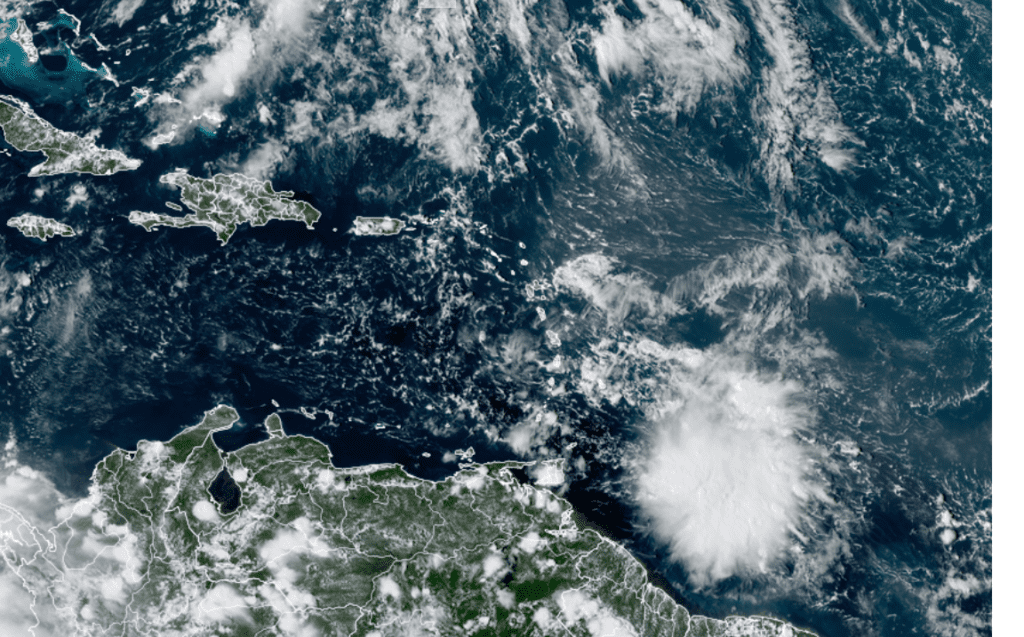
A new tropical system may develop in the Caribbean Sea later this week. National Hurricane Center forecasters are closely monitoring a broad area of low pressure located a couple of hundred miles east of the southern Windward Islands. This system is producing a fairly large area of showers and thunderstorms to the southeast of an ill-defined center.
NOAA/Colorado State University/RAMMB 10/04/22 1:30 pm CDT
Upper-level winds are currently unfavorable for tropical development, but will likely become more conducive for development over the next couple of days. A tropical depression could form if the system stays far enough away from land as it moves westward at about 15 mph across the Windward Islands and southeastern Caribbean Sea. Conditions appear to become more conducive for development later this week when the system reaches
the central and western Caribbean Sea. Regardless of development, locally heavy rainfall and gusty winds are expected over portions of the Windward Islands Tuesday night and Wednesday. An Air Force Reserve Hurricane Hunter aircraft was investigating the disturbance Tuesday afternoon, and its data will help determine if the system is indeed developing.
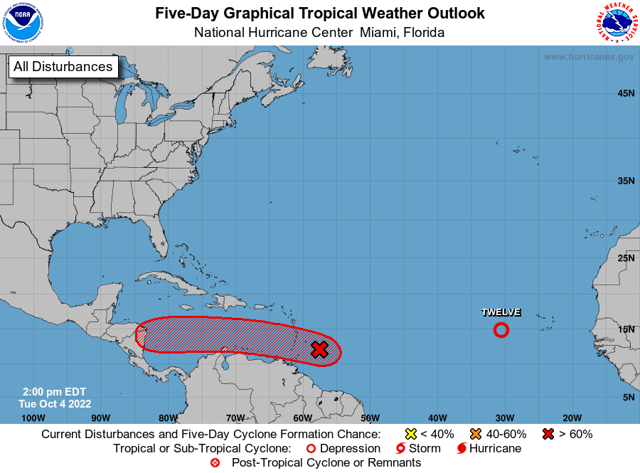
The area of low pressure is being pushed to the west by an east-west oriented ridge of high pressure that currently stretches from the southwestern Atlantic, to the Bay of Campeche. Th position of the ridge is unlike the pattern that was in place last week with Ian, where a trough of low pressure over the eastern U.S. pulled the hurricane north across Florida and into the Carolinas. In the current pattern, upper-level winds flowing around the ridge are predicted to push the low westward toward Central America. With the ridge in place, a path toward the western Gulf of Mexico appears very unlikely.
Bob
Social Media