Tuesday’s forecast data continues to indicate a fairly good chance for widespread rain developing across much of Texas next Sunday through Monday when a cold front slowly pushes to the southeast. Unlike most atmospheric setups we’ve seen so far this spring, the setup ahead of and behind this cold front appears favorable for the development of rain and thunderstorms. It’s possible some of the storms may even become strong to severe.
The most favorable period for rain is expected to occur between late Sunday afternoon and late Monday afternoon along the cold front. The chance for rain is forecast to diminish from northwest to southeast Monday night into Tuesday morning as drier air spreads in to the area.
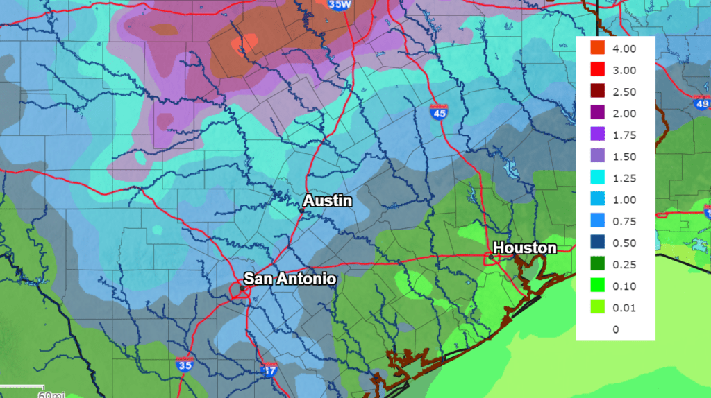
The National Weather Service is predicting rain amounts through next Tuesday to be heaviest across the Hill Country, where general totals of 1-1.5 inches are forecast. Across Central Texas, totals are predicted to average between 0.5 and 1 inch. Meanwhile, across the coastal plains, totals are predicted to generally average between 0.25 and 0.50 inches. Being this rain event is nearly a week away, these totals could fluctuate up or down as we get closer to the event.
NWS Rainfall Forecast for the Period 7 pm Tuesday through 7pm next Tuesday:
Long-range forecasts call for a dry and mild pattern for the second half of next week.
Bob
Social Media